Saint-Léger-lès-Authie
Saint-Léger-lès-Authie | |
|---|---|
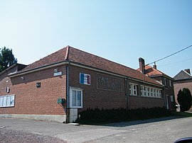 The town hall and school in Saint-Léger-lès-Authie | |
 Coat of arms | |
show Location of Saint-Léger-lès-Authie | |
 Saint-Léger-lès-Authie | |
| Coordinates: 50°07′37″N 2°30′47″E / 50.1269°N 2.5131°ECoordinates: 50°07′37″N 2°30′47″E / 50.1269°N 2.5131°E | |
| Country | France |
| Region | Hauts-de-France |
| Department | Somme |
| Arrondissement | Péronne |
| Canton | Albert |
| Intercommunality | Pays du Coquelicot |
| Government | |
| • Mayor (2020–2026) | Jean-Marie Guenez[1] |
| Area 1 | 4.29 km2 (1.66 sq mi) |
| Population (Jan. 2018)[2] | 86 |
| • Density | 20/km2 (52/sq mi) |
| Time zone | UTC+01:00 (CET) |
| • Summer (DST) | UTC+02:00 (CEST) |
| INSEE/Postal code | 80705 /80560 |
| Elevation | 87–157 m (285–515 ft) (avg. 96 m or 315 ft) |
| 1 French Land Register data, which excludes lakes, ponds, glaciers > 1 km2 (0.386 sq mi or 247 acres) and river estuaries. | |


Saint-Léger-lès-Authie (Picard: Saint-Njèr-lès-Eutie) is a commune in the Somme department in Hauts-de-France in northern France.
Geography[]
The commune is situated some 17 miles (27 km) northeast of Amiens, on the D152 road and on the banks of the Authie, the border with the Pas-de-Calais.
Population[]
| Year | Pop. | ±% p.a. |
|---|---|---|
| 1968 | 102 | — |
| 1975 | 88 | −2.09% |
| 1982 | 82 | −1.00% |
| 1990 | 92 | +1.45% |
| 1999 | 98 | +0.70% |
| 2007 | 90 | −1.06% |
| 2012 | 90 | +0.00% |
| 2017 | 89 | −0.22% |
| Source: INSEE[3] | ||
See also[]
References[]
- ^ "Répertoire national des élus: les maires". data.gouv.fr, Plateforme ouverte des données publiques françaises (in French). 2 December 2020. Retrieved 7 December 2020.
- ^ "Populations légales 2018". INSEE. 28 December 2020.
- ^ Population en historique depuis 1968, INSEE
| Wikimedia Commons has media related to Saint-Léger-lès-Authie. |
Categories:
- Communes of Somme (department)
- Péronne arrondissement geography stubs