Lignières, Somme
Lignières | |
|---|---|
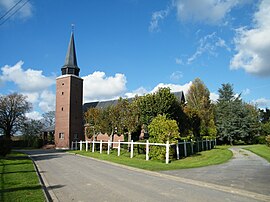
 The church in Lignières | |
 Lignières | |
| Coordinates: 49°40′39″N 2°39′12″E / 49.6775°N 2.6533°ECoordinates: 49°40′39″N 2°39′12″E / 49.6775°N 2.6533°E | |
| Country | France |
| Region | Hauts-de-France |
| Department | Somme |
| Arrondissement | Montdidier |
| Canton | Roye |
| Intercommunality | Grand Roye |
| Government | |
| • Mayor (2020–2026) | Marie-Lise Périn |
| Area 1 | 6.33 km2 (2.44 sq mi) |
| Population (Jan. 2018)[1] | 141 |
| • Density | 22/km2 (58/sq mi) |
| Demonym(s) | Lignièrois, Lignièroises |
| Time zone | UTC+01:00 (CET) |
| • Summer (DST) | UTC+02:00 (CEST) |
| INSEE/Postal code | 80478 /80500 |
| Elevation | 64–109 m (210–358 ft) (avg. 1,100 m or 3,600 ft) |
| 1 French Land Register data, which excludes lakes, ponds, glaciers > 1 km2 (0.386 sq mi or 247 acres) and river estuaries. | |
Lignières (French pronunciation: [liɲɛʁ]) is a commune in the Somme department in Hauts-de-France in northern France.
Geography[]
The commune is situated on the D135e road, some 27 miles (43 km) southeast of Amiens.
Population[]
| Year | Pop. | ±% |
|---|---|---|
| 2004 | 138 | — |
| 2006 | 138 | +0.0% |
| 2007 | 140 | +1.4% |
| 2008 | 141 | +0.7% |
| 2009 | 143 | +1.4% |
| 2010 | 143 | +0.0% |
| 2011 | 144 | +0.7% |
| 2012 | 141 | −2.1% |
| 2013 | 137 | −2.8% |
| 2014 | 134 | −2.2% |
| 2015 | 132 | −1.5% |
| 2016 | 132 | +0.0% |
| 2017 | 137 | +3.8% |
Politics[]
Presidential Elections Second Round:[2]
| Election | Winning Candidate | Party | % | |
|---|---|---|---|---|
| 2017 | Marine Le Pen | FN | 53.13 | |
| 2012 | François Hollande | PS | 52.08 | |
| 2007 | Ségolène Royal | PS | 56.44 | |
| 2002 | Jacques Chirac | RPR | 67.86 | |
See also[]
References[]
| Wikimedia Commons has media related to Lignières (Somme). |
Categories:
- Communes of Somme (department)
- Montdidier arrondissement geography stubs


