Vitz-sur-Authie
Vitz-sur-Authie | |
|---|---|
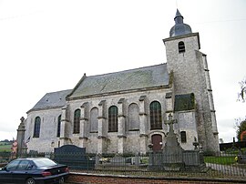 The church in Vitz-sur-Authie | |
show Location of Vitz-sur-Authie | |
 Vitz-sur-Authie | |
| Coordinates: 50°15′13″N 2°03′59″E / 50.2536°N 2.0664°ECoordinates: 50°15′13″N 2°03′59″E / 50.2536°N 2.0664°E | |
| Country | France |
| Region | Hauts-de-France |
| Department | Somme |
| Arrondissement | Abbeville |
| Canton | Rue |
| Intercommunality | Ternois |
| Government | |
| • Mayor (2020–2026) | Michel Van Elslander |
| Area 1 | 4.66 km2 (1.80 sq mi) |
| Population (Jan. 2018)[1] | 128 |
| • Density | 27/km2 (71/sq mi) |
| Time zone | UTC+01:00 (CET) |
| • Summer (DST) | UTC+02:00 (CEST) |
| INSEE/Postal code | 80810 /80150 |
| Elevation | 22–94 m (72–308 ft) (avg. 28 m or 92 ft) |
| 1 French Land Register data, which excludes lakes, ponds, glaciers > 1 km2 (0.386 sq mi or 247 acres) and river estuaries. | |


Vitz-sur-Authie is a commune in the Somme department in Hauts-de-France in northern France.
Geography[]
The commune is situated 16 miles (26 km) northeast of Abbeville, on the D121 road and on the border with the Pas-de-Calais department.
History[]
Also known as Vitz-lès-Willancourt, the commune was once the seigneurie of the d'Abbeville family.
Population[]
| Year | 1962 | 1968 | 1975 | 1982 | 1990 | 1999 | 2006 | 2011 | 2015 |
|---|---|---|---|---|---|---|---|---|---|
| Population | 175 | 175 | 158 | 137 | 122 | 127 | 112 | 116 | 123 |
| From the year 1962 on: No double counting—residents of multiple communes (e.g. students and military personnel) are counted only once. | |||||||||
See also[]
References[]
- ^ "Populations légales 2018". INSEE. 28 December 2020.
| Wikimedia Commons has media related to Vitz-sur-Authie. |
Categories:
- Communes of Somme (department)
- Abbeville arrondissement geography stubs