Tœufles
From Wikipedia, the free encyclopedia
Commune in Hauts-de-France, France
Toeufles | |
|---|---|
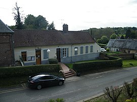 The town hall in Tœufles | |
 Coat of arms | |
Location of Toeufles  | |
 Toeufles  Toeufles | |
Coordinates:  50°04′01″N 1°42′55″E / 50.0669°N 1.7153°E / 50.0669; 1.7153Coordinates: 50°04′01″N 1°42′55″E / 50.0669°N 1.7153°E / 50.0669; 1.7153 50°04′01″N 1°42′55″E / 50.0669°N 1.7153°E / 50.0669; 1.7153Coordinates: 50°04′01″N 1°42′55″E / 50.0669°N 1.7153°E / 50.0669; 1.7153 | |
| Country | France |
| Region | Hauts-de-France |
| Department | Somme |
| Arrondissement | Abbeville |
| Canton | Abbeville-2 |
| Intercommunality | CC Vimeu |
| Government | |
| • Mayor (2020–2026) | Christian Magnier |
| Area 1 | 8.88 km2 (3.43 sq mi) |
| Population (Jan. 2018)[1] | 296 |
| • Density | 33/km2 (86/sq mi) |
| Time zone | UTC+01:00 (CET) |
| • Summer (DST) | UTC+02:00 (CEST) |
| INSEE/Postal code | 80764 /80870 |
| Elevation | 30–114 m (98–374 ft) (avg. 106 m or 348 ft) |
| 1 French Land Register data, which excludes lakes, ponds, glaciers > 1 km2 (0.386 sq mi or 247 acres) and river estuaries. | |
Toeufles is a commune in the Somme department in Hauts-de-France in northern France.
Geography[]
The commune is situated 6 miles (10 km) southwest of Abbeville, on the D22 road, by the banks of the river Trie.
Population[]
| Year | Pop. | ±% p.a. |
|---|---|---|
| 1968 | 367 | — |
| 1975 | 329 | −1.55% |
| 1982 | 305 | −1.08% |
| 1990 | 300 | −0.21% |
| 1999 | 313 | +0.47% |
| 2007 | 284 | −1.21% |
| 2012 | 290 | +0.42% |
| 2017 | 299 | +0.61% |
| Source: INSEE[2] | ||
Places of interest[]
- The church
- Château of Rogeant,
- Château of Toeufles,
See also[]
References[]
- ^ "Populations légales 2018". The National Institute of Statistics and Economic Studies. 28 December 2020.
- ^ Population en historique depuis 1968, INSEE
| Wikimedia Commons has media related to Tœufles. |
Communes of the Somme department | |
|---|---|
|
This Arrondissement of Abbeville geographical article is a stub. You can help Wikipedia by . |
- v
- t
Retrieved from ""
Categories:
- Communes of Somme (department)
- Abbeville arrondissement geography stubs
Hidden categories:
- Articles with short description
- Short description is different from Wikidata
- Infobox mapframe without OSM relation ID on Wikidata
- Coordinates on Wikidata
- Pages using infobox settlement with image map1 but not image map
- Commons category link from Wikidata
- AC with 0 elements
- All stub articles
- Pages using the Kartographer extension