Hombleux
From Wikipedia, the free encyclopedia
Commune in Hauts-de-France, France
Hombleux | |
|---|---|
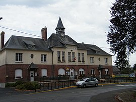 The town hall in Hombleux | |
 Hombleux  Hombleux | |
Coordinates:  49°44′21″N 2°59′10″E / 49.7392°N 2.9861°E / 49.7392; 2.9861Coordinates: 49°44′21″N 2°59′10″E / 49.7392°N 2.9861°E / 49.7392; 2.9861 49°44′21″N 2°59′10″E / 49.7392°N 2.9861°E / 49.7392; 2.9861Coordinates: 49°44′21″N 2°59′10″E / 49.7392°N 2.9861°E / 49.7392; 2.9861 | |
| Country | France |
| Region | Hauts-de-France |
| Department | Somme |
| Arrondissement | Péronne |
| Canton | Ham |
| Intercommunality | CC Est de la Somme |
| Area 1 | 15.81 km2 (6.10 sq mi) |
| Population (Jan. 2018)[1] | 1,177 |
| • Density | 74/km2 (190/sq mi) |
| Time zone | UTC+01:00 (CET) |
| • Summer (DST) | UTC+02:00 (CEST) |
| INSEE/Postal code | 80442 /80400 |
| Elevation | 52–76 m (171–249 ft) (avg. 67 m or 220 ft) |
| 1 French Land Register data, which excludes lakes, ponds, glaciers > 1 km2 (0.386 sq mi or 247 acres) and river estuaries. | |

Hombleux is a commune in the Somme department in Hauts-de-France in northern France. On 1 January 2019, the former commune Grécourt was merged into Hombleux.[2]
Contents
Geography[]
Hombleux is situated at the D154 and D144 road junction, some 16 miles (26 km) southwest of Saint-Quentin.
Population[]
| Year | 1962 | 1968 | 1975 | 1982 | 1990 | 1999 | 2006 |
|---|---|---|---|---|---|---|---|
| Population | 921 | 935 | 1051 | 1140 | 1110 | 1009 | 1026 |
| From the year 1962 on: No double counting—residents of multiple communes (e.g. students and military personnel) are counted only once. | |||||||
See also[]
References[]
- ^ "Populations légales 2018". INSEE. 28 December 2020.
- ^ Arrêté préfectoral 7 December 2018 (in French)
| Wikimedia Commons has media related to Hombleux. |
show
Communes of the Somme department | |
|---|---|
|
This Arrondissement of Péronne geographical article is a stub. You can help Wikipedia by . |
Retrieved from ""
Categories:
- Communes of Somme (department)
- Péronne arrondissement geography stubs
Hidden categories:
- Articles with French-language sources (fr)
- Articles with short description
- Short description is different from Wikidata
- Infobox mapframe without OSM relation ID on Wikidata
- Coordinates on Wikidata
- Pages using infobox settlement with image map1 but not image map
- Commons category link from Wikidata
- Articles with BNF identifiers
- All stub articles
- Pages using the Kartographer extension