La Neuville-lès-Bray
La Neuville-lès-Bray | |
|---|---|
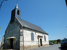 The church in La Neuville-lès-Bray | |
show Location of La Neuville-lès-Bray | |
 La Neuville-lès-Bray | |
| Coordinates: 49°56′01″N 2°43′09″E / 49.9336°N 2.7192°ECoordinates: 49°56′01″N 2°43′09″E / 49.9336°N 2.7192°E | |
| Country | France |
| Region | Hauts-de-France |
| Department | Somme |
| Arrondissement | Péronne |
| Canton | Albert |
| Intercommunality | Pays du Coquelicot |
| Government | |
| • Mayor (2020–2026) | Benoit Dubuisson[1] |
| Area 1 | 4.03 km2 (1.56 sq mi) |
| Population (Jan. 2018)[2] | 263 |
| • Density | 65/km2 (170/sq mi) |
| Time zone | UTC+01:00 (CET) |
| • Summer (DST) | UTC+02:00 (CEST) |
| INSEE/Postal code | 80593 /80340 |
| Elevation | 32–85 m (105–279 ft) (avg. 30 m or 98 ft) |
| 1 French Land Register data, which excludes lakes, ponds, glaciers > 1 km2 (0.386 sq mi or 247 acres) and river estuaries. | |


La Neuville-lès-Bray (French pronunciation: [la nøvil lɛ bʁɛ], literally La Neuville near Bray) is a commune in the Somme department in Hauts-de-France in northern France.
Geography[]
The commune is situated on the D329 road, on the banks of the river Somme, opposite Bray-sur-Somme, 29 kilometres (18 mi) east of Amiens.
Population[]
| Year | 1962 | 1968 | 1975 | 1982 | 1990 | 1999 | 2006 |
|---|---|---|---|---|---|---|---|
| Population | 164 | 175 | 201 | 214 | 215 | 260 | 274 |
| From the year 1962 on: No double counting—residents of multiple communes (e.g. students and military personnel) are counted only once. | |||||||
Places of interest[]
- Froissy Dompierre Light Railway and museum at nearby Froissy.
See also[]
References[]
- ^ "Répertoire national des élus: les maires". data.gouv.fr, Plateforme ouverte des données publiques françaises (in French). 2 December 2020.
- ^ "Populations légales 2018". INSEE. 28 December 2020.
External links[]
| Wikimedia Commons has media related to La Neuville-lès-Bray. |
- La Neuville-lès-Bray official website (in French)
Categories:
- Communes of Somme (department)
- Péronne arrondissement geography stubs