Bacouel-sur-Selle
From Wikipedia, the free encyclopedia
Commune in Hauts-de-France, France
Bacouel-sur-Selle | |
|---|---|
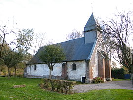 The church of Bacouel-sur-Selle | |
 Coat of arms | |
 Bacouel-sur-Selle  Bacouel-sur-Selle | |
Coordinates:  49°49′53″N 2°13′31″E / 49.8314°N 2.2253°E / 49.8314; 2.2253Coordinates: 49°49′53″N 2°13′31″E / 49.8314°N 2.2253°E / 49.8314; 2.2253 49°49′53″N 2°13′31″E / 49.8314°N 2.2253°E / 49.8314; 2.2253Coordinates: 49°49′53″N 2°13′31″E / 49.8314°N 2.2253°E / 49.8314; 2.2253 | |
| Country | France |
| Region | Hauts-de-France |
| Department | Somme |
| Arrondissement | Amiens |
| Canton | Ailly-sur-Noye |
| Intercommunality | Somme Sud-Ouest |
| Government | |
| • Mayor (2014-2020) | Jean-François Corniquet |
| Area 1 | 6.24 km2 (2.41 sq mi) |
| Population (Jan. 2018)[1] | 493 |
| • Density | 79/km2 (200/sq mi) |
| Time zone | UTC+01:00 (CET) |
| • Summer (DST) | UTC+02:00 (CEST) |
| INSEE/Postal code | 80050 /80480 |
| Elevation | 36–121 m (118–397 ft) (avg. 38 m or 125 ft) |
| 1 French Land Register data, which excludes lakes, ponds, glaciers > 1 km2 (0.386 sq mi or 247 acres) and river estuaries. | |

Bacouel-sur-Selle is a commune in the Somme department in Hauts-de-France in northern France.
Contents
Geography[]
Situated 5 miles (8 km) southwest of Amiens, on the banks of the Selle river, a couple of kilometres from the A16 autoroute junction with the A29.
Population[]
| Year | Pop. | ±% |
|---|---|---|
| 2005 | 525 | — |
| 2006 | 519 | −1.1% |
| 2007 | 516 | −0.6% |
| 2008 | 502 | −2.7% |
| 2009 | 488 | −2.8% |
| 2010 | 474 | −2.9% |
| 2011 | 468 | −1.3% |
| 2012 | 465 | −0.6% |
| 2013 | 479 | +3.0% |
| 2014 | 493 | +2.9% |
| 2015 | 507 | +2.8% |
| 2016 | 504 | −0.6% |
See also[]
References[]
- ^ "Populations légales 2018". INSEE. 28 December 2020.
| Wikimedia Commons has media related to Bacouel-sur-Selle. |
show
Communes of the Somme department | |
|---|---|
|
This Arrondissement of Amiens geographical article is a stub. You can help Wikipedia by . |
- v
- t
Retrieved from ""
Categories:
- Communes of Somme (department)
- Amiens arrondissement geography stubs
Hidden categories:
- Articles with short description
- Short description is different from Wikidata
- Infobox mapframe without OSM relation ID on Wikidata
- Coordinates on Wikidata
- Pages using infobox settlement with image map1 but not image map
- Commons category link is on Wikidata
- Articles with BNF identifiers
- All stub articles
- Pages using the Kartographer extension