Moyencourt-lès-Poix
Moyencourt-lès-Poix | |
|---|---|
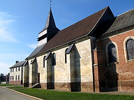 The church in Moyencourt-lès-Poix | |
 Coat of arms | |
Location of Moyencourt-lès-Poix  | |
 Moyencourt-lès-Poix | |
| Coordinates: 49°48′12″N 2°02′10″E / 49.8033°N 2.0361°ECoordinates: 49°48′12″N 2°02′10″E / 49.8033°N 2.0361°E | |
| Country | France |
| Region | Hauts-de-France |
| Department | Somme |
| Arrondissement | Amiens |
| Canton | Poix-de-Picardie |
| Intercommunality | CC Somme Sud-Ouest |
| Government | |
| • Mayor (2020–2026) | Jean-Pierre Demarquet |
| Area 1 | 10.45 km2 (4.03 sq mi) |
| Population (Jan. 2018)[1] | 182 |
| • Density | 17/km2 (45/sq mi) |
| Time zone | UTC+01:00 (CET) |
| • Summer (DST) | UTC+02:00 (CEST) |
| INSEE/Postal code | 80577 /80290 |
| Elevation | 104–177 m (341–581 ft) (avg. 160 m or 520 ft) |
| 1 French Land Register data, which excludes lakes, ponds, glaciers > 1 km2 (0.386 sq mi or 247 acres) and river estuaries. | |


Moyencourt-lès-Poix (French pronunciation: [mwajɛ̃kuʁ lɛ pwa], literally Moyencourt near Poix) is a commune in the Somme department in Hauts-de-France in northern France.
Geography[]
The commune is situated just off the N29, on the D94 road, some 15 miles (24 km) southwest of Amiens. Not to be confused with another commune, Moyencourt, further east in the same département.
Population[]
| Year | Pop. | ±% p.a. |
|---|---|---|
| 1968 | 153 | — |
| 1975 | 171 | +1.60% |
| 1982 | 172 | +0.08% |
| 1990 | 159 | −0.98% |
| 1999 | 159 | +0.00% |
| 2007 | 161 | +0.16% |
| 2012 | 166 | +0.61% |
| 2017 | 181 | +1.75% |
| Source: INSEE[2] | ||

The Chateau pavillon
See also[]
References[]
- ^ "Populations légales 2018". The National Institute of Statistics and Economic Studies. 28 December 2020.
- ^ Population en historique depuis 1968, INSEE
| Wikimedia Commons has media related to Moyencourt-lès-Poix. |
Categories:
- Communes of Somme (department)
- Amiens arrondissement geography stubs