Halloy-lès-Pernois
Halloy-lès-Pernois | |
|---|---|
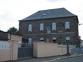 The town hall in Halloy-lès-Pernois | |
show Location of Halloy-lès-Pernois | |
 Halloy-lès-Pernois | |
| Coordinates: 50°03′01″N 2°11′52″E / 50.0503°N 2.1978°ECoordinates: 50°03′01″N 2°11′52″E / 50.0503°N 2.1978°E | |
| Country | France |
| Region | Hauts-de-France |
| Department | Somme |
| Arrondissement | Amiens |
| Canton | Flixecourt |
| Intercommunality | CC Nièvre et Somme |
| Government | |
| • Mayor (2020–2026) | Philippe Carpentier[1] |
| Area 1 | 6.2 km2 (2.4 sq mi) |
| Population (Jan. 2018)[2] | 339 |
| • Density | 55/km2 (140/sq mi) |
| Time zone | UTC+01:00 (CET) |
| • Summer (DST) | UTC+02:00 (CEST) |
| INSEE/Postal code | 80408 /80670 |
| Elevation | 38–128 m (125–420 ft) (avg. 42 m or 138 ft) |
| 1 French Land Register data, which excludes lakes, ponds, glaciers > 1 km2 (0.386 sq mi or 247 acres) and river estuaries. | |


Halloy-lès-Pernois is a commune in the Somme department in Hauts-de-France in northern France.
Geography[]
The commune is situated on the D57 road, some 17 miles (27 km) northwest of Amiens.
Population[]
| Year | 1962 | 1968 | 1975 | 1982 | 1990 | 1999 | 2006 |
|---|---|---|---|---|---|---|---|
| Population | 153 | 172 | 195 | 319 | 341 | 355 | 372 |
| From the year 1962 on: No double counting—residents of multiple communes (e.g. students and military personnel) are counted only once. | |||||||
See also[]
References[]
- ^ "Répertoire national des élus: les maires". data.gouv.fr, Plateforme ouverte des données publiques françaises (in French). 2 December 2020.
- ^ "Populations légales 2018". INSEE. 28 December 2020.
| Wikimedia Commons has media related to Halloy-lès-Pernois. |
Categories:
- Communes of Somme (department)
- Amiens arrondissement geography stubs