Guillaucourt
Guillaucourt | |
|---|---|
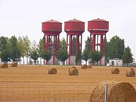 Water towers in Guillaucourt | |
show Location of Guillaucourt | |
 Guillaucourt | |
| Coordinates: 49°50′34″N 2°37′56″E / 49.8428°N 2.6322°ECoordinates: 49°50′34″N 2°37′56″E / 49.8428°N 2.6322°E | |
| Country | France |
| Region | Hauts-de-France |
| Department | Somme |
| Arrondissement | Péronne |
| Canton | Moreuil |
| Intercommunality | CC Terre de Picardie |
| Government | |
| • Mayor (2020–2026) | Ludovic Kusnierak[1] |
| Area 1 | 6.37 km2 (2.46 sq mi) |
| Population (Jan. 2018)[2] | 427 |
| • Density | 67/km2 (170/sq mi) |
| Time zone | UTC+01:00 (CET) |
| • Summer (DST) | UTC+02:00 (CEST) |
| INSEE/Postal code | 80400 /80170 |
| Elevation | 52–96 m (171–315 ft) (avg. 87 m or 285 ft) |
| 1 French Land Register data, which excludes lakes, ponds, glaciers > 1 km2 (0.386 sq mi or 247 acres) and river estuaries. | |


Guillaucourt is a commune in the Somme department in Hauts-de-France in northern France.
Geography[]
Guillaucourt is situated 16 miles (26 km) southeast of Amiens at the D165 and D136 junction and very close to the A29 autoroute.
Population[]
| Year | 1962 | 1968 | 1975 | 1982 | 1990 | 1999 | 2006 |
|---|---|---|---|---|---|---|---|
| Population | 317 | 340 | 323 | 302 | 296 | 305 | 378 |
| From the year 1962 on: No double counting—residents of multiple communes (e.g. students and military personnel) are counted only once. | |||||||
See also[]
References[]
- ^ "Répertoire national des élus: les maires". data.gouv.fr, Plateforme ouverte des données publiques françaises (in French). 2 December 2020.
- ^ "Populations légales 2018". INSEE. 28 December 2020.
| Wikimedia Commons has media related to Guillaucourt. |
Categories:
- Communes of Somme (department)
- Péronne arrondissement geography stubs