Maraussan
Maraussan | |
|---|---|
 A view of old Maraussan | |
 Coat of arms | |
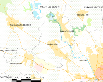
show Location of Maraussan | |
 Maraussan | |
| Coordinates: 43°22′03″N 3°09′31″E / 43.3675°N 3.1586°ECoordinates: 43°22′03″N 3°09′31″E / 43.3675°N 3.1586°E | |
| Country | France |
| Region | Occitanie |
| Department | Hérault |
| Arrondissement | Béziers |
| Canton | Cazouls-lès-Béziers |
| Intercommunality | Domitienne |
| Government | |
| • Mayor (2020–2026) | Serge Pesce[1] |
| Area 1 | 12.37 km2 (4.78 sq mi) |
| Population (Jan. 2018)[2] | 4,514 |
| • Density | 360/km2 (950/sq mi) |
| Time zone | UTC+01:00 (CET) |
| • Summer (DST) | UTC+02:00 (CEST) |
| INSEE/Postal code | 34148 /34370 |
| Elevation | 8–92 m (26–302 ft) (avg. 38 m or 125 ft) |
| 1 French Land Register data, which excludes lakes, ponds, glaciers > 1 km2 (0.386 sq mi or 247 acres) and river estuaries. | |


Maraussan is a commune in the Hérault department in southern France.
It lies approximately 8 km northwest of Béziers, on route D14 ( Av de Béziers ), a busy route for commuters to Béziers.
Chateau Perdiguier lies just outside the town on the cross road D39 (Route de Tarbaka) leading down to the river Orb.
Map
Population[]
| Year | Pop. | ±% |
|---|---|---|
| 1962 | 1,595 | — |
| 1968 | 1,655 | +3.8% |
| 1975 | 2,088 | +26.2% |
| 1982 | 2,154 | +3.2% |
| 1990 | 2,336 | +8.4% |
| 1999 | 2,782 | +19.1% |
| 2008 | 3,448 | +23.9% |
See also[]
References[]
- ^ "Répertoire national des élus: les maires". data.gouv.fr, Plateforme ouverte des données publiques françaises (in French). 2 December 2020.
- ^ "Populations légales 2018". INSEE. 28 December 2020.
| Wikimedia Commons has media related to Maraussan. |
| show Authority control |
|---|
This Hérault geographical article is a stub. You can help Wikipedia by . |
Categories:
- Communes of Hérault
- Hérault geography stubs