Roujan
Roujan | |
|---|---|
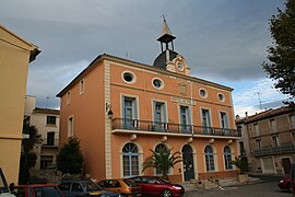 Town hall | |
 Coat of arms | |
show Location of Roujan | |
 Roujan | |
| Coordinates: 43°30′20″N 3°18′41″E / 43.5056°N 3.3114°ECoordinates: 43°30′20″N 3°18′41″E / 43.5056°N 3.3114°E | |
| Country | France |
| Region | Occitanie |
| Department | Hérault |
| Arrondissement | Béziers |
| Canton | Cazouls-lès-Béziers |
| Intercommunality | CC Les Avant-Monts |
| Government | |
| • Mayor (2020–2026) | Jean Blanquefort |
| Area 1 | 17.02 km2 (6.57 sq mi) |
| Population (Jan. 2018)[1] | 2,169 |
| • Density | 130/km2 (330/sq mi) |
| Time zone | UTC+01:00 (CET) |
| • Summer (DST) | UTC+02:00 (CEST) |
| INSEE/Postal code | 34237 /34320 |
| Elevation | 49–246 m (161–807 ft) (avg. 115 m or 377 ft) |
| 1 French Land Register data, which excludes lakes, ponds, glaciers > 1 km2 (0.386 sq mi or 247 acres) and river estuaries. | |


Roujan (French pronunciation: [ʁuʒɑ̃]; Occitan: Rojan) is a commune in the Hérault department in the Occitanie region in southern France, about 22 km north of Beziers.
Sights[]
Cassan Abbey, an 18th-century historical monument is located in the commune on the road to Faugères.
Population[]
| Year | Pop. | ±% |
|---|---|---|
| 1962 | 1,461 | — |
| 1968 | 1,481 | +1.4% |
| 1975 | 1,379 | −6.9% |
| 1982 | 1,409 | +2.2% |
| 1990 | 1,366 | −3.1% |
| 1999 | 1,486 | +8.8% |
| 2008 | 1,946 | +31.0% |
Personalities[]
- Jules Roucairol, victim of Napoléon III's coup d'état
See also[]
References[]
- ^ "Populations légales 2018". INSEE. 28 December 2020.
| Wikimedia Commons has media related to Roujan. |
| show Authority control |
|---|
This Hérault geographical article is a stub. You can help Wikipedia by . |
Categories:
- Communes of Hérault
- Hérault geography stubs