Saint-Hilaire-de-Beauvoir
Saint-Hilaire-de-Beauvoir | |
|---|---|
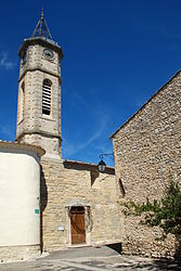 The church of Saint-Hilaire-de-Beauvoir | |
 Coat of arms | |
show Location of Saint-Hilaire-de-Beauvoir | |
 Saint-Hilaire-de-Beauvoir | |
| Coordinates: 43°45′25″N 4°00′52″E / 43.7569°N 4.0144°ECoordinates: 43°45′25″N 4°00′52″E / 43.7569°N 4.0144°E | |
| Country | France |
| Region | Occitanie |
| Department | Hérault |
| Arrondissement | Lodève |
| Canton | Saint-Gély-du-Fesc |
| Government | |
| • Mayor (2008–2014) | Marie-Claude Caizergues |
| Area 1 | 4.69 km2 (1.81 sq mi) |
| Population (Jan. 2018)[1] | 426 |
| • Density | 91/km2 (240/sq mi) |
| Time zone | UTC+01:00 (CET) |
| • Summer (DST) | UTC+02:00 (CEST) |
| INSEE/Postal code | 34263 /34160 |
| Elevation | 39–86 m (128–282 ft) (avg. 80 m or 260 ft) |
| 1 French Land Register data, which excludes lakes, ponds, glaciers > 1 km2 (0.386 sq mi or 247 acres) and river estuaries. | |


Saint-Hilaire-de-Beauvoir is a commune in the Hérault department in the Occitanie region in southern France.
Population[]
| Year | Pop. | ±% |
|---|---|---|
| 1962 | 119 | — |
| 1968 | 136 | +14.3% |
| 1975 | 125 | −8.1% |
| 1982 | 131 | +4.8% |
| 1990 | 167 | +27.5% |
| 1999 | 273 | +63.5% |
| 2008 | 351 | +28.6% |
See also[]
References[]
- ^ "Populations légales 2018". INSEE. 28 December 2020.
| Wikimedia Commons has media related to Saint-Hilaire-de-Beauvoir. |
| show Authority control |
|---|
This Hérault geographical article is a stub. You can help Wikipedia by . |
Categories:
- Communes of Hérault
- Hérault geography stubs