Éloyes
Éloyes | |
|---|---|
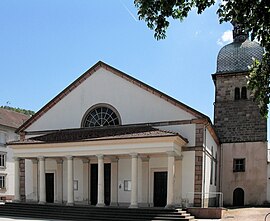 Church of the Assumption of the Virgin | |
 Coat of arms | |
show Location of Éloyes | |
 Éloyes | |
| Coordinates: 48°05′48″N 6°36′37″E / 48.0967°N 6.6103°ECoordinates: 48°05′48″N 6°36′37″E / 48.0967°N 6.6103°E | |
| Country | France |
| Region | Grand Est |
| Department | Vosges |
| Arrondissement | Épinal |
| Canton | Remiremont |
| Intercommunality | CC Porte des Vosges Méridionales |
| Government | |
| • Mayor (2020–2026) | André Lacquemin[1] |
| Area 1 | 12.51 km2 (4.83 sq mi) |
| Population (Jan. 2018)[2] | 3,137 |
| • Density | 250/km2 (650/sq mi) |
| Time zone | UTC+01:00 (CET) |
| • Summer (DST) | UTC+02:00 (CEST) |
| INSEE/Postal code | 88158 /88510 |
| Elevation | 361–781 m (1,184–2,562 ft) (avg. 387 m or 1,270 ft) |
| 1 French Land Register data, which excludes lakes, ponds, glaciers > 1 km2 (0.386 sq mi or 247 acres) and river estuaries. | |


Éloyes is a commune in the Vosges department in Grand Est in northeastern France.
See also[]
References[]
- ^ "Répertoire national des élus: les maires". data.gouv.fr, Plateforme ouverte des données publiques françaises (in French). 2 December 2020. Retrieved 7 December 2020.
- ^ "Populations légales 2018". INSEE. 28 December 2020.
| Wikimedia Commons has media related to Éloyes. |
| show Authority control |
|---|
This Vosges geographical article is a stub. You can help Wikipedia by . |
Categories:
- Communes of Vosges (department)
- Vosges (department) geography stubs