Gruey-lès-Surance
Gruey-lès-Surance | |
|---|---|
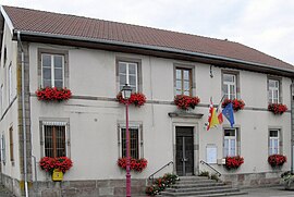 Town hall | |
show Location of Gruey-lès-Surance | |
 Gruey-lès-Surance | |
| Coordinates: 48°02′19″N 6°11′06″E / 48.0386°N 6.185°ECoordinates: 48°02′19″N 6°11′06″E / 48.0386°N 6.185°E | |
| Country | France |
| Region | Grand Est |
| Department | Vosges |
| Arrondissement | Épinal |
| Canton | Le Val-d'Ajol |
| Intercommunality | CA Épinal |
| Government | |
| • Mayor (2008–2014) | Christiane Lagaude |
| Area 1 | 27.1 km2 (10.5 sq mi) |
| Population (Jan. 2018)[1] | 250 |
| • Density | 9.2/km2 (24/sq mi) |
| Time zone | UTC+01:00 (CET) |
| • Summer (DST) | UTC+02:00 (CEST) |
| INSEE/Postal code | 88221 /88240 |
| Elevation | 323–488 m (1,060–1,601 ft) (avg. 422 m or 1,385 ft) |
| 1 French Land Register data, which excludes lakes, ponds, glaciers > 1 km2 (0.386 sq mi or 247 acres) and river estuaries. | |


Gruey-lès-Surance is a commune in the Vosges department in Grand Est in northeastern France.
See also[]
References[]
- ^ "Populations légales 2018". INSEE. 28 December 2020.
| Wikimedia Commons has media related to Gruey-lès-Surance. |
This Vosges geographical article is a stub. You can help Wikipedia by . |
Categories:
- Communes of Vosges (department)
- Vosges (department) geography stubs