Laveline-du-Houx
Laveline-du-Houx | |
|---|---|
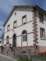 The town hall in Laveline-du-Houx | |
 Coat of arms | |
show Location of Laveline-du-Houx | |
 Laveline-du-Houx | |
| Coordinates: 48°08′09″N 6°42′20″E / 48.1358°N 6.7056°ECoordinates: 48°08′09″N 6°42′20″E / 48.1358°N 6.7056°E | |
| Country | France |
| Region | Grand Est |
| Department | Vosges |
| Arrondissement | Épinal |
| Canton | Bruyères |
| Intercommunality | CC Bruyères - Vallons des Vosges |
| Government | |
| • Mayor (2008–2014) | Michel Boca |
| Area 1 | 8.21 km2 (3.17 sq mi) |
| Population (Jan. 2018)[1] | 205 |
| • Density | 25/km2 (65/sq mi) |
| Time zone | UTC+01:00 (CET) |
| • Summer (DST) | UTC+02:00 (CEST) |
| INSEE/Postal code | 88263 /88640 |
| Elevation | 444–710 m (1,457–2,329 ft) |
| 1 French Land Register data, which excludes lakes, ponds, glaciers > 1 km2 (0.386 sq mi or 247 acres) and river estuaries. | |


Laveline-du-Houx is a commune in the Vosges department in Grand Est in northeastern France.
See also[]
References[]
- ^ "Populations légales 2018". INSEE. 28 December 2020.
| Wikimedia Commons has media related to Laveline-du-Houx. |
This Vosges geographical article is a stub. You can help Wikipedia by . |
Categories:
- Communes of Vosges (department)
- Vosges (department) geography stubs