Lerrain
Lerrain | |
|---|---|
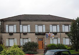 The town hall in Lerrain | |
show Location of Lerrain | |
 Lerrain | |
| Coordinates: 48°08′37″N 6°08′55″E / 48.1436°N 6.1486°ECoordinates: 48°08′37″N 6°08′55″E / 48.1436°N 6.1486°E | |
| Country | France |
| Region | Grand Est |
| Department | Vosges |
| Arrondissement | Neufchâteau |
| Canton | Darney |
| Intercommunality | CC Vosges côté Sud-Ouest |
| Government | |
| • Mayor (2020–2026) | Frédéric Balaud |
| Area 1 | 12.65 km2 (4.88 sq mi) |
| Population (Jan. 2018)[1] | 458 |
| • Density | 36/km2 (94/sq mi) |
| Time zone | UTC+01:00 (CET) |
| • Summer (DST) | UTC+02:00 (CEST) |
| INSEE/Postal code | 88267 /88260 |
| Elevation | 300–381 m (984–1,250 ft) (avg. 317 m or 1,040 ft) |
| 1 French Land Register data, which excludes lakes, ponds, glaciers > 1 km2 (0.386 sq mi or 247 acres) and river estuaries. | |


Lerrain (French pronunciation: [lɛʁɛ̃] (![]() listen)) is a commune in the Vosges department in Grand Est in northeastern France.
listen)) is a commune in the Vosges department in Grand Est in northeastern France.
Geography[]
The river Madon flows through the commune.
See also[]
References[]
- ^ "Populations légales 2018". INSEE. 28 December 2020.
| Wikimedia Commons has media related to Lerrain. |
This Vosges geographical article is a stub. You can help Wikipedia by . |
Categories:
- Communes of Vosges (department)
- Vosges (department) geography stubs