Gerbamont
Gerbamont | |
|---|---|
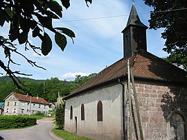 Chapel of Saint-Del | |
 Coat of arms | |
show Location of Gerbamont | |
 Gerbamont | |
| Coordinates: 48°00′20″N 6°45′19″E / 48.0056°N 6.7553°ECoordinates: 48°00′20″N 6°45′19″E / 48.0056°N 6.7553°E | |
| Country | France |
| Region | Grand Est |
| Department | Vosges |
| Arrondissement | Saint-Dié-des-Vosges |
| Canton | La Bresse |
| Intercommunality | CC Hautes Vosges |
| Government | |
| • Mayor (2008–2014) | Danielle Poirot |
| Area 1 | 9.69 km2 (3.74 sq mi) |
| Population (Jan. 2018)[1] | 357 |
| • Density | 37/km2 (95/sq mi) |
| Time zone | UTC+01:00 (CET) |
| • Summer (DST) | UTC+02:00 (CEST) |
| INSEE/Postal code | 88197 /88120 |
| Elevation | 409–1,023 m (1,342–3,356 ft) |
| 1 French Land Register data, which excludes lakes, ponds, glaciers > 1 km2 (0.386 sq mi or 247 acres) and river estuaries. | |


Gerbamont is a commune in the Vosges department in Grand Est in northeastern France.
See also[]
References[]
- ^ "Populations légales 2018". INSEE. 28 December 2020.
| Wikimedia Commons has media related to Gerbamont. |
This Vosges geographical article is a stub. You can help Wikipedia by . |
Categories:
- Communes of Vosges (department)
- Vosges (department) geography stubs