Morizécourt
Morizécourt | |
|---|---|
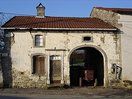 A house in Morizécourt | |
 Coat of arms | |
show Location of Morizécourt | |
 Morizécourt | |
| Coordinates: 48°04′16″N 5°51′40″E / 48.0711°N 5.8611°ECoordinates: 48°04′16″N 5°51′40″E / 48.0711°N 5.8611°E | |
| Country | France |
| Region | Grand Est |
| Department | Vosges |
| Arrondissement | Neufchâteau |
| Canton | Darney |
| Intercommunality | CC Vosges côté Sud-Ouest |
| Government | |
| • Mayor (2020–2026) | Alexandre Destrignéville |
| Area 1 | 10.68 km2 (4.12 sq mi) |
| Population (Jan. 2018)[1] | 104 |
| • Density | 9.7/km2 (25/sq mi) |
| Time zone | UTC+01:00 (CET) |
| • Summer (DST) | UTC+02:00 (CEST) |
| INSEE/Postal code | 88314 /88320 |
| Elevation | 279–422 m (915–1,385 ft) (avg. 350 m or 1,150 ft) |
| 1 French Land Register data, which excludes lakes, ponds, glaciers > 1 km2 (0.386 sq mi or 247 acres) and river estuaries. | |


Morizécourt is a commune in the Vosges department in Grand Est in northeastern France.
The Benedictine priory at Morizécourt dates from 1624.
See also[]
References[]
- ^ "Populations légales 2018". INSEE. 28 December 2020.
| Wikimedia Commons has media related to Morizécourt. |
| show Authority control |
|---|
This Vosges geographical article is a stub. You can help Wikipedia by . |
Categories:
- Communes of Vosges (department)
- Vosges (department) geography stubs