Bocquegney
Bocquegney | |
|---|---|
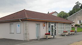 The town hall in Bocquegney | |
show Location of Bocquegney | |
 Bocquegney | |
| Coordinates: 48°13′16″N 6°18′14″E / 48.2211°N 6.3039°ECoordinates: 48°13′16″N 6°18′14″E / 48.2211°N 6.3039°E | |
| Country | France |
| Region | Grand Est |
| Department | Vosges |
| Arrondissement | Épinal |
| Canton | Darney |
| Intercommunality | CC Mirecourt Dompaire |
| Government | |
| • Mayor (2020–2026) | Jean-Marie Thomas[1] |
| Area 1 | 4.57 km2 (1.76 sq mi) |
| Population (Jan. 2018)[2] | 134 |
| • Density | 29/km2 (76/sq mi) |
| Time zone | UTC+01:00 (CET) |
| • Summer (DST) | UTC+02:00 (CEST) |
| INSEE/Postal code | 88063 /88270 |
| Elevation | 332–411 m (1,089–1,348 ft) (avg. 375 m or 1,230 ft) |
| 1 French Land Register data, which excludes lakes, ponds, glaciers > 1 km2 (0.386 sq mi or 247 acres) and river estuaries. | |


Bocquegney (French pronunciation: [bɔkɲɛ] (![]() listen)) is a commune in the Vosges department in Grand Est in northeastern France.
listen)) is a commune in the Vosges department in Grand Est in northeastern France.
See also[]
References[]
- ^ "Répertoire national des élus: les maires". data.gouv.fr, Plateforme ouverte des données publiques françaises (in French). 2 December 2020.
- ^ "Populations légales 2018". INSEE. 28 December 2020.
| Wikimedia Commons has media related to Bocquegney. |
This Vosges geographical article is a stub. You can help Wikipedia by . |
Categories:
- Communes of Vosges (department)
- Vosges (department) geography stubs