Gerbépal
Gerbépal | |
|---|---|
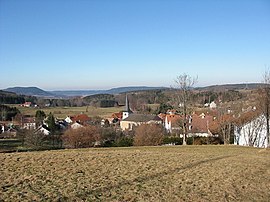 A general view of Gerbépal | |
 Coat of arms | |
show Location of Gerbépal | |
 Gerbépal | |
| Coordinates: 48°09′03″N 6°55′22″E / 48.1508°N 6.9228°ECoordinates: 48°09′03″N 6°55′22″E / 48.1508°N 6.9228°E | |
| Country | France |
| Region | Grand Est |
| Department | Vosges |
| Arrondissement | Saint-Dié-des-Vosges |
| Canton | Gérardmer |
| Intercommunality | CA Saint-Dié-des-Vosges |
| Government | |
| • Mayor (2020–2026) | Bernard Thomas[1] |
| Area 1 | 19.18 km2 (7.41 sq mi) |
| Population (Jan. 2018)[2] | 595 |
| • Density | 31/km2 (80/sq mi) |
| Time zone | UTC+01:00 (CET) |
| • Summer (DST) | UTC+02:00 (CEST) |
| INSEE/Postal code | 88198 /88430 |
| Elevation | 583–1,083 m (1,913–3,553 ft) (avg. 630 m or 2,070 ft) |
| 1 French Land Register data, which excludes lakes, ponds, glaciers > 1 km2 (0.386 sq mi or 247 acres) and river estuaries. | |


Gerbépal (French pronunciation: [ʒɛʁbepal] (![]() listen)) is a commune in the Vosges department in Grand Est in northeastern France.
listen)) is a commune in the Vosges department in Grand Est in northeastern France.
See also[]
References[]
- ^ "Répertoire national des élus: les maires". data.gouv.fr, Plateforme ouverte des données publiques françaises (in French). 2 December 2020.
- ^ "Populations légales 2018". INSEE. 28 December 2020.
External links[]
| Wikimedia Commons has media related to Gerbépal. |
| show Authority control |
|---|
This Vosges geographical article is a stub. You can help Wikipedia by . |
Categories:
- Communes of Vosges (department)
- Vosges (department) geography stubs