Bellefontaine, Vosges
Bellefontaine | |
|---|---|
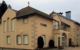 The town hall in Bellefontaine | |
 Coat of arms | |
show Location of Bellefontaine | |
 Bellefontaine | |
| Coordinates: 48°00′50″N 6°26′37″E / 48.0139°N 6.4436°ECoordinates: 48°00′50″N 6°26′37″E / 48.0139°N 6.4436°E | |
| Country | France |
| Region | Grand Est |
| Department | Vosges |
| Arrondissement | Épinal |
| Canton | Le Val-d'Ajol |
| Intercommunality | CA Épinal |
| Government | |
| • Mayor (2008–2014) | Jean-Michel Georges |
| Area 1 | 39.11 km2 (15.10 sq mi) |
| Population (Jan. 2018)[1] | 986 |
| • Density | 25/km2 (65/sq mi) |
| Time zone | UTC+01:00 (CET) |
| • Summer (DST) | UTC+02:00 (CEST) |
| INSEE/Postal code | 88048 /88370 |
| Elevation | 440–614 m (1,444–2,014 ft) (avg. 550 m or 1,800 ft) |
| 1 French Land Register data, which excludes lakes, ponds, glaciers > 1 km2 (0.386 sq mi or 247 acres) and river estuaries. | |


Bellefontaine is a commune in the Vosges department in Grand Est in northeastern France.
See also[]
References[]
- ^ "Populations légales 2018". INSEE. 28 December 2020.
| Wikimedia Commons has media related to Bellefontaine (Vosges). |
This Vosges geographical article is a stub. You can help Wikipedia by . |
Categories:
- Communes of Vosges (department)
- Vosges (department) geography stubs