Les Poulières
Les Poulières | |
|---|---|
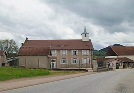 The town hall in Les Poulières | |
show Location of Les Poulières | |
 Les Poulières | |
| Coordinates: 48°11′54″N 6°47′30″E / 48.1983°N 6.7917°ECoordinates: 48°11′54″N 6°47′30″E / 48.1983°N 6.7917°E | |
| Country | France |
| Region | Grand Est |
| Department | Vosges |
| Arrondissement | Saint-Dié-des-Vosges |
| Canton | Bruyères |
| Intercommunality | CA Saint-Dié-des-Vosges |
| Government | |
| • Mayor (2020–2026) | Jean-Luc Thiriet |
| Area 1 | 2.98 km2 (1.15 sq mi) |
| Population (Jan. 2018)[1] | 256 |
| • Density | 86/km2 (220/sq mi) |
| Time zone | UTC+01:00 (CET) |
| • Summer (DST) | UTC+02:00 (CEST) |
| INSEE/Postal code | 88356 /88660 |
| Elevation | 451–663 m (1,480–2,175 ft) (avg. 456 m or 1,496 ft) |
| 1 French Land Register data, which excludes lakes, ponds, glaciers > 1 km2 (0.386 sq mi or 247 acres) and river estuaries. | |


Les Poulières (French pronunciation: [le puljɛʁ] (![]() listen)) is a commune in the Vosges department in Grand Est in northeastern France.
listen)) is a commune in the Vosges department in Grand Est in northeastern France.
Inhabitants are called Polérois.
Geography[]
The commune is positioned between Épinal to the west and Saint-Dié to the north-east, in the valley of the Neuné, a tributary of the Vologne River. Neighbouring communes are Biffontaine and La Chapelle-devant-Bruyères. Les Poulières is at the confluence of several roads, but roads here are small and twisting, thanks to the topography, on the western fringes of the Vosges Mountains.
See also[]
References[]
- ^ "Populations légales 2018". INSEE. 28 December 2020.
| Wikimedia Commons has media related to Les Poulières. |
This Vosges geographical article is a stub. You can help Wikipedia by . |
Categories:
- Communes of Vosges (department)
- Vosges (department) geography stubs