Médonville
Médonville | |
|---|---|
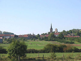 A general view of Médonville | |
show Location of Médonville | |
 Médonville | |
| Coordinates: 48°13′12″N 5°43′55″E / 48.22°N 5.7319°ECoordinates: 48°13′12″N 5°43′55″E / 48.22°N 5.7319°E | |
| Country | France |
| Region | Grand Est |
| Department | Vosges |
| Arrondissement | Neufchâteau |
| Canton | Vittel |
| Intercommunality | CC Terre d'eau |
| Government | |
| • Mayor (2020–2026) | Patricia Pech |
| Area 1 | 7.27 km2 (2.81 sq mi) |
| Population (Jan. 2018)[1] | 87 |
| • Density | 12/km2 (31/sq mi) |
| Time zone | UTC+01:00 (CET) |
| • Summer (DST) | UTC+02:00 (CEST) |
| INSEE/Postal code | 88296 /88140 |
| Elevation | 316–491 m (1,037–1,611 ft) (avg. 330 m or 1,080 ft) |
| 1 French Land Register data, which excludes lakes, ponds, glaciers > 1 km2 (0.386 sq mi or 247 acres) and river estuaries. | |


Médonville is a commune in the Vosges department in Grand Est in northeastern France.
See also[]
References[]
- ^ "Populations légales 2018". INSEE. 28 December 2020.
| Wikimedia Commons has media related to Médonville. |
| show Authority control |
|---|
This Vosges geographical article is a stub. You can help Wikipedia by . |
Categories:
- Communes of Vosges (department)
- Vosges (department) geography stubs