Le Puid
Le Puid | |
|---|---|
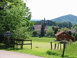 The church and surroundings in Le Puid | |
show Location of Le Puid | |
 Le Puid | |
| Coordinates: 48°23′37″N 7°02′28″E / 48.3936°N 7.0411°ECoordinates: 48°23′37″N 7°02′28″E / 48.3936°N 7.0411°E | |
| Country | France |
| Region | Grand Est |
| Department | Vosges |
| Arrondissement | Saint-Dié-des-Vosges |
| Canton | Raon-l'Étape |
| Intercommunality | CA Saint-Dié-des-Vosges |
| Government | |
| • Mayor (2008–2014) | Claude Sublon |
| Area 1 | 5.41 km2 (2.09 sq mi) |
| Population (Jan. 2018)[1] | 107 |
| • Density | 20/km2 (51/sq mi) |
| Time zone | UTC+01:00 (CET) |
| • Summer (DST) | UTC+02:00 (CEST) |
| INSEE/Postal code | 88362 /88210 |
| Elevation | 400–643 m (1,312–2,110 ft) |
| 1 French Land Register data, which excludes lakes, ponds, glaciers > 1 km2 (0.386 sq mi or 247 acres) and river estuaries. | |


Le Puid is a commune in the Vosges department in Grand Est in northeastern France.
Inhabitants are called Piedestains.
History[]
Until 1793 Le Puid was part of the Principality of Salm-Salm.
See also[]
References[]
- ^ "Populations légales 2018". INSEE. 28 December 2020.
| Wikimedia Commons has media related to Le Puid. |
This Vosges geographical article is a stub. You can help Wikipedia by . |
Categories:
- Communes of Vosges (department)
- Vosges (department) geography stubs