Ahéville
Ahéville | |
|---|---|
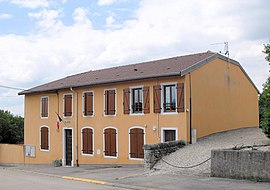 The town hall in Ahéville | |
Location of Ahéville  | |
 Ahéville | |
| Coordinates: 48°17′10″N 6°11′35″E / 48.286°N 6.193°ECoordinates: 48°17′10″N 6°11′35″E / 48.286°N 6.193°E | |
| Country | France |
| Region | Grand Est |
| Department | Vosges |
| Arrondissement | Épinal |
| Canton | Darney |
| Intercommunality | Mirecourt Dompaire |
| Government | |
| • Mayor (2020–2026) | Véronique Muniere[1] |
| Area 1 | 5.84 km2 (2.25 sq mi) |
| Population (Jan. 2018)[2] | 71 |
| • Density | 12/km2 (31/sq mi) |
| Time zone | UTC+01:00 (CET) |
| • Summer (DST) | UTC+02:00 (CEST) |
| INSEE/Postal code | 88002 /88500 |
| Elevation | 308–401 m (1,010–1,316 ft) (avg. 339 m or 1,112 ft) |
| 1 French Land Register data, which excludes lakes, ponds, glaciers > 1 km2 (0.386 sq mi or 247 acres) and river estuaries. | |


Ahéville (French pronunciation: [a.evil] (![]() listen)) is a commune in the Vosges department in Grand Est in northeastern France.
listen)) is a commune in the Vosges department in Grand Est in northeastern France.
Population[]
| Year | Pop. | ±% |
|---|---|---|
| 2006 | 64 | — |
| 2007 | 63 | −1.6% |
| 2008 | 62 | −1.6% |
| 2009 | 61 | −1.6% |
| 2010 | 59 | −3.3% |
| 2011 | 58 | −1.7% |
| 2012 | 57 | −1.7% |
| 2013 | 57 | +0.0% |
| 2014 | 60 | +5.3% |
| 2015 | 64 | +6.7% |
| 2016 | 67 | +4.7% |
See also[]
References[]
- ^ "Répertoire national des élus: les maires". data.gouv.fr, Plateforme ouverte des données publiques françaises (in French). 9 August 2021.
- ^ "Populations légales 2018". The National Institute of Statistics and Economic Studies. 28 December 2020.
| Wikimedia Commons has media related to Ahéville. |
This Vosges geographical article is a stub. You can help Wikipedia by . |
Categories:
- Communes of Vosges (department)
- Vosges (department) geography stubs