Valfroicourt
Valfroicourt | |
|---|---|
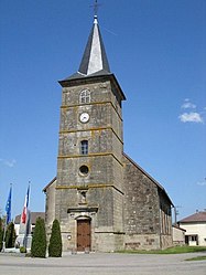 The church in Valfroicourt | |
show Location of Valfroicourt | |
 Valfroicourt | |
| Coordinates: 48°11′55″N 6°05′44″E / 48.1986°N 6.0956°ECoordinates: 48°11′55″N 6°05′44″E / 48.1986°N 6.0956°E | |
| Country | France |
| Region | Grand Est |
| Department | Vosges |
| Arrondissement | Neufchâteau |
| Canton | Vittel |
| Intercommunality | CC Terre d'eau |
| Government | |
| • Mayor (2008–2014) | Marcel Lœgel |
| Area 1 | 13.8 km2 (5.3 sq mi) |
| Population (Jan. 2018)[1] | 239 |
| • Density | 17/km2 (45/sq mi) |
| Time zone | UTC+01:00 (CET) |
| • Summer (DST) | UTC+02:00 (CEST) |
| INSEE/Postal code | 88488 /88270 |
| Elevation | 295–419 m (968–1,375 ft) (avg. 310 m or 1,020 ft) |
| 1 French Land Register data, which excludes lakes, ponds, glaciers > 1 km2 (0.386 sq mi or 247 acres) and river estuaries. | |


Valfroicourt is a commune in the Vosges department in Grand Est in northeastern France.
See also[]
References[]
- ^ "Populations légales 2018". INSEE. 28 December 2020.
| Wikimedia Commons has media related to Valfroicourt. |
This Vosges geographical article is a stub. You can help Wikipedia by . |
Categories:
- Communes of Vosges (department)
- Vosges (department) geography stubs