Bazien
This article needs additional citations for verification. (February 2019) |
Bazien | |
|---|---|
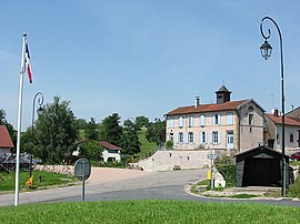 Town hall | |
show Location of Bazien | |
 Bazien | |
| Coordinates: 48°24′43″N 6°40′40″E / 48.4119°N 6.6778°ECoordinates: 48°24′43″N 6°40′40″E / 48.4119°N 6.6778°E | |
| Country | France |
| Region | Grand Est |
| Department | Vosges |
| Arrondissement | Épinal |
| Canton | Raon-l'Étape |
| Intercommunality | CC Région de Rambervillers |
| Government | |
| • Mayor (2008–2014) | Gérard Valbonetti |
| Area 1 | 3.21 km2 (1.24 sq mi) |
| Population (Jan. 2018)[1] | 79 |
| • Density | 25/km2 (64/sq mi) |
| Time zone | UTC+01:00 (CET) |
| • Summer (DST) | UTC+02:00 (CEST) |
| INSEE/Postal code | 88042 /88700 |
| Elevation | 283–371 m (928–1,217 ft) (avg. 350 m or 1,150 ft) |
| 1 French Land Register data, which excludes lakes, ponds, glaciers > 1 km2 (0.386 sq mi or 247 acres) and river estuaries. | |


Bazien is a commune in the Vosges department in Grand Est in northeastern France.
See also[]
References[]
- ^ "Populations légales 2018". INSEE. 28 December 2020.
| Wikimedia Commons has media related to Bazien. |
This Vosges geographical article is a stub. You can help Wikipedia by . |
Categories:
- Communes of Vosges (department)
- Vosges (department) geography stubs