Landaville
Landaville | |
|---|---|
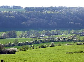 The Vallée du Bany in Landaville | |
show Location of Landaville | |
 Landaville | |
| Coordinates: 48°17′21″N 5°44′40″E / 48.2892°N 5.7444°ECoordinates: 48°17′21″N 5°44′40″E / 48.2892°N 5.7444°E | |
| Country | France |
| Region | Grand Est |
| Department | Vosges |
| Arrondissement | Neufchâteau |
| Canton | Neufchâteau |
| Intercommunality | CC l'Ouest Vosgien |
| Government | |
| • Mayor (2008–2014) | René Maillard |
| Area 1 | 13.06 km2 (5.04 sq mi) |
| Population (Jan. 2018)[1] | 299 |
| • Density | 23/km2 (59/sq mi) |
| Time zone | UTC+01:00 (CET) |
| • Summer (DST) | UTC+02:00 (CEST) |
| INSEE/Postal code | 88259 /88300 |
| Elevation | 311–483 m (1,020–1,585 ft) (avg. 340 m or 1,120 ft) |
| 1 French Land Register data, which excludes lakes, ponds, glaciers > 1 km2 (0.386 sq mi or 247 acres) and river estuaries. | |


Landaville is a commune in the Vosges department in Grand Est in northeastern France.
See also[]
References[]
- ^ "Populations légales 2018". INSEE. 28 December 2020.
| Wikimedia Commons has media related to Landaville. |
This Vosges geographical article is a stub. You can help Wikipedia by . |
Categories:
- Communes of Vosges (department)
- Vosges (department) geography stubs