Dignonville
Dignonville | |
|---|---|
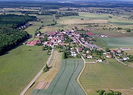 A general view of Dignonville | |
show Location of Dignonville | |
 Dignonville | |
| Coordinates: 48°14′39″N 6°30′23″E / 48.2442°N 6.5064°ECoordinates: 48°14′39″N 6°30′23″E / 48.2442°N 6.5064°E | |
| Country | France |
| Region | Grand Est |
| Department | Vosges |
| Arrondissement | Épinal |
| Canton | Épinal-2 |
| Intercommunality | CA Épinal |
| Government | |
| • Mayor (2008–2014) | Bernard Rivot |
| Area 1 | 5.93 km2 (2.29 sq mi) |
| Population (Jan. 2018)[1] | 195 |
| • Density | 33/km2 (85/sq mi) |
| Time zone | UTC+01:00 (CET) |
| • Summer (DST) | UTC+02:00 (CEST) |
| INSEE/Postal code | 88133 /88000 |
| Elevation | 322–400 m (1,056–1,312 ft) (avg. 345 m or 1,132 ft) |
| 1 French Land Register data, which excludes lakes, ponds, glaciers > 1 km2 (0.386 sq mi or 247 acres) and river estuaries. | |


Dignonville is a commune in the Vosges department in Grand Est in northeastern France.
See also[]
References[]
- ^ "Populations légales 2018". INSEE. 28 December 2020.
| Wikimedia Commons has media related to Dignonville. |
This Vosges geographical article is a stub. You can help Wikipedia by . |
Categories:
- Communes of Vosges (department)
- Vosges (department) geography stubs