Le Syndicat
Le Syndicat | |
|---|---|
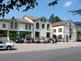 Town hall and assembly hall | |
 Coat of arms | |
show Location of Le Syndicat | |
 Le Syndicat | |
| Coordinates: 48°01′28″N 6°41′07″E / 48.0244°N 6.6853°ECoordinates: 48°01′28″N 6°41′07″E / 48.0244°N 6.6853°E | |
| Country | France |
| Region | Grand Est |
| Department | Vosges |
| Arrondissement | Saint-Dié-des-Vosges |
| Canton | La Bresse |
| Intercommunality | CC Hautes Vosges |
| Government | |
| • Mayor (2020–2026) | Pascal Claude |
| Area 1 | 18.29 km2 (7.06 sq mi) |
| Population (Jan. 2018)[1] | 1,885 |
| • Density | 100/km2 (270/sq mi) |
| Time zone | UTC+01:00 (CET) |
| • Summer (DST) | UTC+02:00 (CEST) |
| INSEE/Postal code | 88462 /88120 |
| Elevation | 392–822 m (1,286–2,697 ft) |
| 1 French Land Register data, which excludes lakes, ponds, glaciers > 1 km2 (0.386 sq mi or 247 acres) and river estuaries. | |


Le Syndicat (French pronunciation: [lə sɛ̃dika] (![]() listen)) is a commune in the Vosges department in Grand Est in northeastern France.
listen)) is a commune in the Vosges department in Grand Est in northeastern France.
See also[]
References[]
- ^ "Populations légales 2018". INSEE. 28 December 2020.
| Wikimedia Commons has media related to Le Syndicat. |
This Vosges geographical article is a stub. You can help Wikipedia by . |
Categories:
- Communes of Vosges (department)
- Vosges (department) geography stubs