Fauconcourt
Fauconcourt | |
|---|---|
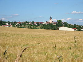 A general view of Fauconcourt | |
show Location of Fauconcourt | |
 Fauconcourt | |
| Coordinates: 48°22′24″N 6°32′29″E / 48.3733°N 6.5414°ECoordinates: 48°22′24″N 6°32′29″E / 48.3733°N 6.5414°E | |
| Country | France |
| Region | Grand Est |
| Department | Vosges |
| Arrondissement | Épinal |
| Canton | Charmes |
| Intercommunality | CC Région de Rambervillers |
| Government | |
| • Mayor (2008–2014) | Gérard Vincent |
| Area 1 | 4.9 km2 (1.9 sq mi) |
| Population (Jan. 2018)[1] | 131 |
| • Density | 27/km2 (69/sq mi) |
| Time zone | UTC+01:00 (CET) |
| • Summer (DST) | UTC+02:00 (CEST) |
| INSEE/Postal code | 88168 /88700 |
| Elevation | 274–358 m (899–1,175 ft) (avg. 340 m or 1,120 ft) |
| 1 French Land Register data, which excludes lakes, ponds, glaciers > 1 km2 (0.386 sq mi or 247 acres) and river estuaries. | |


Fauconcourt is a commune in the Vosges department in Grand Est in northeastern France.
See also[]
References[]
- ^ "Populations légales 2018". INSEE. 28 December 2020.
| Wikimedia Commons has media related to Fauconcourt. |
This Vosges geographical article is a stub. You can help Wikipedia by . |
Categories:
- Communes of Vosges (department)
- Vosges (department) geography stubs