Anlhiac
Anlhiac | |
|---|---|
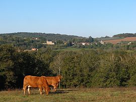 A general view of Anlhiac | |
 Coat of arms | |
show Location of Anlhiac | |
 Anlhiac | |
| Coordinates: 45°19′21″N 1°07′37″E / 45.3225°N 1.1269°ECoordinates: 45°19′21″N 1°07′37″E / 45.3225°N 1.1269°E | |
| Country | France |
| Region | Nouvelle-Aquitaine |
| Department | Dordogne |
| Arrondissement | Nontron |
| Canton | Isle-Loue-Auvézère |
| Government | |
| • Mayor (2020–2026) | Philippe Faure |
| Area 1 | 11.86 km2 (4.58 sq mi) |
| Population (Jan. 2018)[1] | 272 |
| • Density | 23/km2 (59/sq mi) |
| Time zone | UTC+01:00 (CET) |
| • Summer (DST) | UTC+02:00 (CEST) |
| INSEE/Postal code | 24009 /24160 |
| Elevation | 141–333 m (463–1,093 ft) (avg. 236 m or 774 ft) |
| 1 French Land Register data, which excludes lakes, ponds, glaciers > 1 km2 (0.386 sq mi or 247 acres) and river estuaries. | |


Anlhiac (French pronunciation: [ɑ̃ljak]; Occitan: Anlhac) is a commune in the Dordogne department in Nouvelle-Aquitaine in southwestern France.
Population[]
| Year | Pop. | ±% |
|---|---|---|
| 1845 | 845 | — |
| 1962 | 320 | −62.1% |
| 1968 | 347 | +8.4% |
| 1975 | 303 | −12.7% |
| 1982 | 330 | +8.9% |
| 1990 | 269 | −18.5% |
| 1999 | 300 | +11.5% |
| 2008 | 285 | −5.0% |
Sights[]
- Slate quarries
See also[]
References[]
- ^ "Populations légales 2018". INSEE. 28 December 2020.
| Wikimedia Commons has media related to Anlhiac. |
| show Authority control |
|---|
This Dordogne geographical article is a stub. You can help Wikipedia by . |
Categories:
- Communes of Dordogne
- Dordogne geography stubs