Augignac
Augignac | |
|---|---|
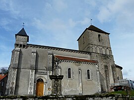 The church in Augignac | |
show Location of Augignac | |
 Augignac | |
| Coordinates: 45°42′06″N 0°35′31″E / 45.7016°N 0.592°ECoordinates: 45°42′06″N 0°35′31″E / 45.7016°N 0.592°E | |
| Country | France |
| Region | Nouvelle-Aquitaine |
| Department | Dordogne |
| Arrondissement | Nontron |
| Canton | Périgord Vert Nontronnais |
| Intercommunality | Périgord Nontronnais |
| Government | |
| • Mayor (2020–2026) | Bernard Bazinet |
| Area 1 | 22.64 km2 (8.74 sq mi) |
| Population (Jan. 2018)[1] | 819 |
| • Density | 36/km2 (94/sq mi) |
| Time zone | UTC+01:00 (CET) |
| • Summer (DST) | UTC+02:00 (CEST) |
| INSEE/Postal code | 24016 /24300 |
| Elevation | 189–306 m (620–1,004 ft) |
| 1 French Land Register data, which excludes lakes, ponds, glaciers > 1 km2 (0.386 sq mi or 247 acres) and river estuaries. | |


Augignac (French pronunciation: [oʒiɲak]; Occitan: Auginhac) is a commune in the Dordogne department in Nouvelle-Aquitaine in southwestern France.
Augignac is located between Nontron and Piégut-Pluviers in the heart of the Parc Naturel Régional de Périgord-Limousin
Population[]
| Year | Pop. | ±% |
|---|---|---|
| 1962 | 798 | — |
| 1968 | 876 | +9.8% |
| 1975 | 791 | −9.7% |
| 1982 | 818 | +3.4% |
| 1990 | 838 | +2.4% |
| 1999 | 791 | −5.6% |
| 2008 | 826 | +4.4% |
| 2015 | 815 | −1.3% |
See also[]
References[]
- ^ "Populations légales 2018". INSEE. 28 December 2020.
External links[]
| Wikimedia Commons has media related to Augignac. |
| show Authority control |
|---|
This Dordogne geographical article is a stub. You can help Wikipedia by . |
Categories:
- Communes of Dordogne
- Dordogne geography stubs