Capdrot
From Wikipedia, the free encyclopedia
Commune in Nouvelle-Aquitaine, France
Commune in Nouvelle-Aquitaine, France
Capdrot | |
|---|---|
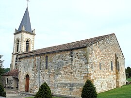 The church in Capdrot | |
 Capdrot  Capdrot | |
Coordinates:  44°40′56″N 0°55′25″E / 44.6822°N 0.9236°E / 44.6822; 0.9236Coordinates: 44°40′56″N 0°55′25″E / 44.6822°N 0.9236°E / 44.6822; 0.9236 44°40′56″N 0°55′25″E / 44.6822°N 0.9236°E / 44.6822; 0.9236Coordinates: 44°40′56″N 0°55′25″E / 44.6822°N 0.9236°E / 44.6822; 0.9236 | |
| Country | France |
| Region | Nouvelle-Aquitaine |
| Department | Dordogne |
| Arrondissement | Bergerac |
| Canton | Lalinde |
| Government | |
| • Mayor (2008–2014) | Jacques Magimel-Pelonnier |
| Area 1 | 43.72 km2 (16.88 sq mi) |
| Population (Jan. 2018)[1] | 489 |
| • Density | 11/km2 (29/sq mi) |
| Time zone | UTC+01:00 (CET) |
| • Summer (DST) | UTC+02:00 (CEST) |
| INSEE/Postal code | 24080 /24540 |
| Elevation | 143–288 m (469–945 ft) (avg. 150 m or 490 ft) |
| 1 French Land Register data, which excludes lakes, ponds, glaciers > 1 km2 (0.386 sq mi or 247 acres) and river estuaries. | |

Capdrot is a commune in the Dordogne department in Nouvelle-Aquitaine in southwestern France.
Population[]
| Year | Pop. | ±% |
|---|---|---|
| 1864 | 1,177 | — |
| 1962 | 505 | −57.1% |
| 1968 | 435 | −13.9% |
| 1975 | 469 | +7.8% |
| 1982 | 467 | −0.4% |
| 1990 | 502 | +7.5% |
| 1999 | 507 | +1.0% |
| 2008 | 491 | −3.2% |
See also[]
References[]
- ^ "Populations légales 2018". INSEE. 28 December 2020.
| Wikimedia Commons has media related to Capdrot. |
| show Authority control | |
|---|---|
| General |
|
| National libraries | |
This Dordogne geographical article is a stub. You can help Wikipedia by . |
- v
- t
Retrieved from ""
Categories:
- Communes of Dordogne
- Dordogne geography stubs
Hidden categories:
- Articles with short description
- Short description is different from Wikidata
- Infobox mapframe without OSM relation ID on Wikidata
- Coordinates on Wikidata
- Pages using infobox settlement with image map1 but not image map
- Commons category link from Wikidata
- Articles with VIAF identifiers
- Articles with BNF identifiers
- Articles with WorldCat-VIAF identifiers
- All stub articles
- Pages using the Kartographer extension