Gabillou
Gabillou | |
|---|---|
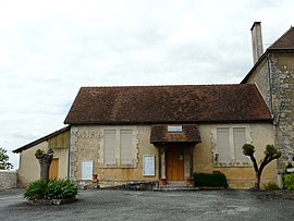 The town hall in Gabillou | |
show Location of Gabillou | |
 Gabillou | |
| Coordinates: 45°12′24″N 1°02′08″E / 45.2067°N 1.0356°ECoordinates: 45°12′24″N 1°02′08″E / 45.2067°N 1.0356°E | |
| Country | France |
| Region | Nouvelle-Aquitaine |
| Department | Dordogne |
| Arrondissement | Sarlat-la-Canéda |
| Canton | Haut-Périgord Noir |
| Intercommunality | |
| Government | |
| • Mayor (2020–2026) | Gaston Grand[1] |
| Area 1 | 7.92 km2 (3.06 sq mi) |
| Population (Jan. 2018)[2] | 93 |
| • Density | 12/km2 (30/sq mi) |
| Time zone | UTC+01:00 (CET) |
| • Summer (DST) | UTC+02:00 (CEST) |
| INSEE/Postal code | 24192 /24210 |
| Elevation | 145–238 m (476–781 ft) (avg. 221 m or 725 ft) |
| 1 French Land Register data, which excludes lakes, ponds, glaciers > 1 km2 (0.386 sq mi or 247 acres) and river estuaries. | |


Gabillou is a commune in the Dordogne department in Nouvelle-Aquitaine in southwestern France.
Population[]
| Year | Pop. | ±% |
|---|---|---|
| 2004 | 106 | — |
| 2006 | 105 | −0.9% |
| 2007 | 102 | −2.9% |
| 2008 | 98 | −3.9% |
| 2009 | 95 | −3.1% |
| 2010 | 92 | −3.2% |
| 2011 | 90 | −2.2% |
| 2012 | 92 | +2.2% |
| 2013 | 94 | +2.2% |
| 2014 | 96 | +2.1% |
| 2015 | 96 | +0.0% |
| 2016 | 96 | +0.0% |
See also[]
References[]
- ^ "Répertoire national des élus: les maires". data.gouv.fr, Plateforme ouverte des données publiques françaises (in French). 2 December 2020.
- ^ "Populations légales 2018". INSEE. 28 December 2020.
| Wikimedia Commons has media related to Gabillou. |
| show Authority control |
|---|
This Dordogne geographical article is a stub. You can help Wikipedia by . |
Categories:
- Communes of Dordogne
- Dordogne geography stubs