Lavaur, Dordogne
Lavaur | |
|---|---|
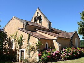 The church in Lavaur | |
show Location of Lavaur | |
 Lavaur | |
| Coordinates: 44°36′51″N 1°01′27″E / 44.6142°N 1.0242°ECoordinates: 44°36′51″N 1°01′27″E / 44.6142°N 1.0242°E | |
| Country | France |
| Region | Nouvelle-Aquitaine |
| Department | Dordogne |
| Arrondissement | Sarlat-la-Canéda |
| Canton | Vallée Dordogne |
| Government | |
| • Mayor (2020–2026) | Michel Lapouge[1] |
| Area 1 | 9.00 km2 (3.47 sq mi) |
| Population (Jan. 2018)[2] | 70 |
| • Density | 7.8/km2 (20/sq mi) |
| Time zone | UTC+01:00 (CET) |
| • Summer (DST) | UTC+02:00 (CEST) |
| INSEE/Postal code | 24232 /24550 |
| Elevation | 135–282 m (443–925 ft) (avg. 250 m or 820 ft) |
| 1 French Land Register data, which excludes lakes, ponds, glaciers > 1 km2 (0.386 sq mi or 247 acres) and river estuaries. | |


Lavaur (French pronunciation: [lavɔʁ]; Occitan: La Vaur) is a commune in the Dordogne department in Nouvelle-Aquitaine in southwestern France.
Population[]
| Year | Pop. | ±% |
|---|---|---|
| 1962 | 151 | — |
| 1968 | 153 | +1.3% |
| 1975 | 113 | −26.1% |
| 1982 | 107 | −5.3% |
| 1990 | 102 | −4.7% |
| 1999 | 88 | −13.7% |
| 2008 | 84 | −4.5% |
See also[]
References[]
- ^ "Répertoire national des élus: les maires". data.gouv.fr, Plateforme ouverte des données publiques françaises (in French). 2 December 2020.
- ^ "Populations légales 2018". INSEE. 28 December 2020.
| Wikimedia Commons has media related to Lavaur (Dordogne). |
| show Authority control |
|---|
This Dordogne geographical article is a stub. You can help Wikipedia by . |
Categories:
- Communes of Dordogne
- Dordogne geography stubs