Mouleydier
Mouleydier | |
|---|---|
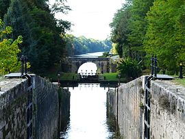 Locks on the Canal de Lalinde | |
 Coat of arms | |
show Location of Mouleydier | |
 Mouleydier | |
| Coordinates: 44°51′23″N 0°35′48″E / 44.8564°N 0.5967°ECoordinates: 44°51′23″N 0°35′48″E / 44.8564°N 0.5967°E | |
| Country | France |
| Region | Nouvelle-Aquitaine |
| Department | Dordogne |
| Arrondissement | Bergerac |
| Canton | Bergerac-2 |
| Government | |
| • Mayor (2020–2026) | Michel Delfieux[1] |
| Area 1 | 8.49 km2 (3.28 sq mi) |
| Population (Jan. 2018)[2] | 1,133 |
| • Density | 130/km2 (350/sq mi) |
| Time zone | UTC+01:00 (CET) |
| • Summer (DST) | UTC+02:00 (CEST) |
| INSEE/Postal code | 24296 /24520 |
| Elevation | 17–132 m (56–433 ft) (avg. 36 m or 118 ft) |
| 1 French Land Register data, which excludes lakes, ponds, glaciers > 1 km2 (0.386 sq mi or 247 acres) and river estuaries. | |


Mouleydier (French pronunciation: [muledje]; Occitan: Montleidièr) is a commune in the Dordogne department in Nouvelle-Aquitaine in southwestern France.
Mouleydier is the site of a bridge over the Dordogne River.
History[]
On June 21, 1944 the SS pillaged and burned Mouleydier and shot to death 22 members of the Resistance.
Population[]
| Year | Pop. | ±% |
|---|---|---|
| 1962 | 940 | — |
| 1968 | 989 | +5.2% |
| 1975 | 983 | −0.6% |
| 1982 | 966 | −1.7% |
| 1990 | 1,049 | +8.6% |
| 1999 | 1,061 | +1.1% |
| 2008 | 1,007 | −5.1% |
See also[]
References[]
- ^ "Répertoire national des élus: les maires". data.gouv.fr, Plateforme ouverte des données publiques françaises (in French). 2 December 2020.
- ^ "Populations légales 2018". INSEE. 28 December 2020.
| Wikimedia Commons has media related to Mouleydier. |
| show Authority control |
|---|
This Dordogne geographical article is a stub. You can help Wikipedia by . |
Categories:
- Communes of Dordogne
- Dordogne geography stubs