Étupes
Étupes | |
|---|---|
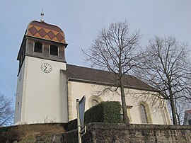 The church in Étupes | |
 Coat of arms | |
show Location of Étupes | |
 Étupes | |
| Coordinates: 47°30′25″N 6°51′43″E / 47.5069°N 6.8619°ECoordinates: 47°30′25″N 6°51′43″E / 47.5069°N 6.8619°E | |
| Country | France |
| Region | Bourgogne-Franche-Comté |
| Department | Doubs |
| Arrondissement | Montbéliard |
| Canton | Bethoncourt |
| Intercommunality | Pays de Montbéliard Agglomération |
| Government | |
| • Mayor (2020–2026) | Philippe Claudel |
| Area 1 | 9.87 km2 (3.81 sq mi) |
| Population (Jan. 2018)[1] | 3,726 |
| • Density | 380/km2 (980/sq mi) |
| Time zone | UTC+01:00 (CET) |
| • Summer (DST) | UTC+02:00 (CEST) |
| INSEE/Postal code | 25228 /25460 |
| Elevation | 319–406 m (1,047–1,332 ft) |
| 1 French Land Register data, which excludes lakes, ponds, glaciers > 1 km2 (0.386 sq mi or 247 acres) and river estuaries. | |


Étupes (French pronunciation: [etyp]) is a commune in the Doubs department in the Bourgogne-Franche-Comté region in eastern France.
Population[]
| Year | Pop. | ±% |
|---|---|---|
| 1962 | 2,471 | — |
| 1968 | 5,198 | +110.4% |
| 1975 | 5,250 | +1.0% |
| 1982 | 4,671 | −11.0% |
| 1990 | 3,603 | −22.9% |
| 1999 | 3,543 | −1.7% |
| 2008 | 3,428 | −3.2% |
| 2012 | 3,581 | +4.5% |
See also[]
References[]
- ^ "Populations légales 2018". INSEE. 28 December 2020.
| Wikimedia Commons has media related to Étupes. |
This Doubs geographical article is a stub. You can help Wikipedia by . |
Categories:
- Communes of Doubs
- County of Montbéliard
- Doubs geography stubs