Appenans
Appenans | |
|---|---|
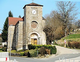 The church in Appenans | |
show Location of Appenans | |
 Appenans | |
| Coordinates: 47°26′37″N 6°33′56″E / 47.4436°N 6.5656°ECoordinates: 47°26′37″N 6°33′56″E / 47.4436°N 6.5656°E | |
| Country | France |
| Region | Bourgogne-Franche-Comté |
| Department | Doubs |
| Arrondissement | Montbéliard |
| Canton | Bavans |
| Government | |
| • Mayor (2008–2014) | Pierre Mourey |
| Area 1 | 4.07 km2 (1.57 sq mi) |
| Population (Jan. 2018)[1] | 379 |
| • Density | 93/km2 (240/sq mi) |
| Time zone | UTC+01:00 (CET) |
| • Summer (DST) | UTC+02:00 (CEST) |
| INSEE/Postal code | 25019 /25250 |
| Elevation | 284–400 m (932–1,312 ft) |
| 1 French Land Register data, which excludes lakes, ponds, glaciers > 1 km2 (0.386 sq mi or 247 acres) and river estuaries. | |


Appenans is a commune in the Doubs department in the Bourgogne-Franche-Comté region in eastern France.
Population[]
| Year | Pop. | ±% |
|---|---|---|
| 1962 | 252 | — |
| 1968 | 259 | +2.8% |
| 1975 | 286 | +10.4% |
| 1982 | 316 | +10.5% |
| 1990 | 357 | +13.0% |
| 1999 | 412 | +15.4% |
| 2008 | 419 | +1.7% |
| 2012 | 424 | +1.2% |
See also[]
References[]
- ^ "Populations légales 2018". INSEE. 28 December 2020.
| Wikimedia Commons has media related to Appenans. |
This Doubs geographical article is a stub. You can help Wikipedia by . |
Categories:
- Communes of Doubs
- Doubs geography stubs