Flangebouche
Flangebouche | |
|---|---|
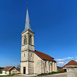 The church in Flangebouche | |
show Location of Flangebouche | |
 Flangebouche | |
| Coordinates: 47°08′27″N 6°28′21″E / 47.1408°N 6.4725°ECoordinates: 47°08′27″N 6°28′21″E / 47.1408°N 6.4725°E | |
| Country | France |
| Region | Bourgogne-Franche-Comté |
| Department | Doubs |
| Arrondissement | Pontarlier |
| Canton | Valdahon |
| Intercommunality | Portes du Haut-Doubs |
| Government | |
| • Mayor (2020–2026) | Fabrice Vivot |
| Area 1 | 23.27 km2 (8.98 sq mi) |
| Population (Jan. 2018)[1] | 783 |
| • Density | 34/km2 (87/sq mi) |
| Time zone | UTC+01:00 (CET) |
| • Summer (DST) | UTC+02:00 (CEST) |
| INSEE/Postal code | 25243 /25390 |
| Elevation | 685–1,056 m (2,247–3,465 ft) |
| 1 French Land Register data, which excludes lakes, ponds, glaciers > 1 km2 (0.386 sq mi or 247 acres) and river estuaries. | |


Flangebouche (French pronunciation: [flɑ̃ʒbuʃ]) is a commune in the Doubs department in the Bourgogne-Franche-Comté region in eastern France.
Population[]
| Year | Pop. | ±% |
|---|---|---|
| 1962 | 559 | — |
| 1968 | 582 | +4.1% |
| 1975 | 523 | −10.1% |
| 1982 | 527 | +0.8% |
| 1990 | 558 | +5.9% |
| 1999 | 549 | −1.6% |
| 2008 | 648 | +18.0% |
| 2012 | 711 | +9.7% |
See also[]
References[]
- ^ "Populations légales 2018". INSEE. 28 December 2020.
| Wikimedia Commons has media related to Flangebouche. |
This Doubs geographical article is a stub. You can help Wikipedia by . |
Categories:
- Communes of Doubs
- Doubs geography stubs