La Longeville
La Longeville | |
|---|---|
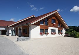 The town hall in La Longeville | |
Location of La Longeville  | |
 La Longeville | |
| Coordinates: 47°00′30″N 6°27′29″E / 47.0083°N 6.4581°ECoordinates: 47°00′30″N 6°27′29″E / 47.0083°N 6.4581°E | |
| Country | France |
| Region | Bourgogne-Franche-Comté |
| Department | Doubs |
| Arrondissement | Pontarlier |
| Canton | Ornans |
| Intercommunality | Montbenoît |
| Government | |
| • Mayor (2020–2026) | Adrien Pellegrini[1] |
| Area 1 | 15.66 km2 (6.05 sq mi) |
| Population (Jan. 2018)[2] | 806 |
| • Density | 51/km2 (130/sq mi) |
| Time zone | UTC+01:00 (CET) |
| • Summer (DST) | UTC+02:00 (CEST) |
| INSEE/Postal code | 25347 /25650 |
| Elevation | 756–991 m (2,480–3,251 ft) |
| 1 French Land Register data, which excludes lakes, ponds, glaciers > 1 km2 (0.386 sq mi or 247 acres) and river estuaries. | |


La Longeville is a commune in the Doubs department in the Bourgogne-Franche-Comté region in eastern France.
Geography[]
The commune lies 5 km (3.1 mi) from Montbenoît, halfway between Pontarlier and Morteau in the Jura mountains near the Swiss border.
Population[]
| Year | Pop. | ±% |
|---|---|---|
| 1962 | 344 | — |
| 1968 | 363 | +5.5% |
| 1975 | 321 | −11.6% |
| 1982 | 352 | +9.7% |
| 1990 | 384 | +9.1% |
| 1999 | 488 | +27.1% |
| 2008 | 610 | +25.0% |
| 2012 | 717 | +17.5% |
See also[]
References[]
- ^ "Répertoire national des élus: les maires". data.gouv.fr, Plateforme ouverte des données publiques françaises (in French). 9 August 2021.
- ^ "Populations légales 2018". The National Institute of Statistics and Economic Studies. 28 December 2020.
External links[]
| Wikimedia Commons has media related to La Longeville. |
|
This Doubs geographical article is a stub. You can help Wikipedia by . |
Categories:
- Communes of Doubs
- Doubs geography stubs