Évillers
Évillers | |
|---|---|
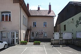 The town hall in Évillers | |
show Location of Évillers | |
 Évillers | |
| Coordinates: 47°00′03″N 6°13′36″E / 47.0008°N 6.2267°ECoordinates: 47°00′03″N 6°13′36″E / 47.0008°N 6.2267°E | |
| Country | France |
| Region | Bourgogne-Franche-Comté |
| Department | Doubs |
| Arrondissement | Pontarlier |
| Canton | Ornans |
| Intercommunality | Altitude 800 |
| Government | |
| • Mayor (2008–2014) | Frédéric Baud |
| Area 1 | 13.02 km2 (5.03 sq mi) |
| Population (Jan. 2018)[1] | 376 |
| • Density | 29/km2 (75/sq mi) |
| Time zone | UTC+01:00 (CET) |
| • Summer (DST) | UTC+02:00 (CEST) |
| INSEE/Postal code | 25229 /25520 |
| Elevation | 690–933 m (2,264–3,061 ft) |
| 1 French Land Register data, which excludes lakes, ponds, glaciers > 1 km2 (0.386 sq mi or 247 acres) and river estuaries. | |


Évillers is a commune in the Doubs department in the Bourgogne-Franche-Comté region in eastern France.
Population[]
| Year | Pop. | ±% |
|---|---|---|
| 1962 | 283 | — |
| 1968 | 305 | +7.8% |
| 1975 | 307 | +0.7% |
| 1982 | 315 | +2.6% |
| 1990 | 283 | −10.2% |
| 1999 | 284 | +0.4% |
| 2008 | 317 | +11.6% |
| 2012 | 332 | +4.7% |
See also[]
References[]
- ^ "Populations légales 2018". INSEE. 28 December 2020.
| Wikimedia Commons has media related to Évillers. |
This Doubs geographical article is a stub. You can help Wikipedia by . |
Categories:
- Communes of Doubs
- Doubs geography stubs