Provenchère, Doubs
Provenchère | |
|---|---|
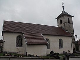 The church in Provenchère | |
show Location of Provenchère | |
 Provenchère | |
| Coordinates: 47°17′24″N 6°38′40″E / 47.29°N 6.6444°ECoordinates: 47°17′24″N 6°38′40″E / 47.29°N 6.6444°E | |
| Country | France |
| Region | Bourgogne-Franche-Comté |
| Department | Doubs |
| Arrondissement | Montbéliard |
| Canton | Valdahon |
| Government | |
| • Mayor (2008–2014) | Claude Roy |
| Area 1 | 6.97 km2 (2.69 sq mi) |
| Population (Jan. 2018)[1] | 137 |
| • Density | 20/km2 (51/sq mi) |
| Time zone | UTC+01:00 (CET) |
| • Summer (DST) | UTC+02:00 (CEST) |
| INSEE/Postal code | 25471 /25380 |
| Elevation | 560–841 m (1,837–2,759 ft) |
| 1 French Land Register data, which excludes lakes, ponds, glaciers > 1 km2 (0.386 sq mi or 247 acres) and river estuaries. | |


Provenchère is a commune in the Doubs department in the Bourgogne-Franche-Comté region in eastern France.
Geography[]
The commune lies 57 km (35 mi) northeast of Besançon, perched above the valley of the Barbèche at the foot of the Mont de Fonteny.
Population[]
| Year | Pop. | ±% |
|---|---|---|
| 1962 | 153 | — |
| 1968 | 164 | +7.2% |
| 1975 | 147 | −10.4% |
| 1982 | 149 | +1.4% |
| 1990 | 127 | −14.8% |
| 1999 | 120 | −5.5% |
| 2008 | 116 | −3.3% |
| 2012 | 131 | +12.9% |
See also[]
References[]
- ^ "Populations légales 2018". INSEE. 28 December 2020.
External links[]
| Wikimedia Commons has media related to Provenchère (Doubs). |
This Doubs geographical article is a stub. You can help Wikipedia by . |
Categories:
- Communes of Doubs
- Doubs geography stubs