Trévillers
Trévillers | |
|---|---|
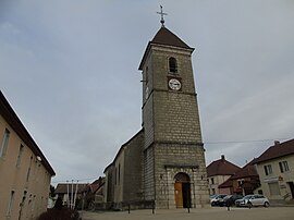 The church in Trévillers | |
 Coat of arms | |
show Location of Trévillers | |
 Trévillers | |
| Coordinates: 47°16′59″N 6°52′12″E / 47.2831°N 6.87°ECoordinates: 47°16′59″N 6°52′12″E / 47.2831°N 6.87°E | |
| Country | France |
| Region | Bourgogne-Franche-Comté |
| Department | Doubs |
| Arrondissement | Montbéliard |
| Canton | Maîche |
| Government | |
| • Mayor (2008–2014) | Gérard Moureaux |
| Area 1 | 10.74 km2 (4.15 sq mi) |
| Population (Jan. 2018)[1] | 489 |
| • Density | 46/km2 (120/sq mi) |
| Time zone | UTC+01:00 (CET) |
| • Summer (DST) | UTC+02:00 (CEST) |
| INSEE/Postal code | 25571 /25470 |
| Elevation | 700–920 m (2,300–3,020 ft) |
| 1 French Land Register data, which excludes lakes, ponds, glaciers > 1 km2 (0.386 sq mi or 247 acres) and river estuaries. | |


Trévillers is a commune in the Doubs department in the Bourgogne-Franche-Comté region in eastern France.
Geography[]
The commune lies 7 km (4.3 mi) northeast of Maîche between Belfort and Pontarlier. It is on the road to Switzerland.
Population[]
| Year | Pop. | ±% |
|---|---|---|
| 1962 | 398 | — |
| 1968 | 400 | +0.5% |
| 1975 | 409 | +2.2% |
| 1982 | 396 | −3.2% |
| 1990 | 410 | +3.5% |
| 1999 | 438 | +6.8% |
| 2008 | 479 | +9.4% |
| 2012 | 473 | −1.3% |
See also[]
References[]
- ^ "Populations légales 2018". INSEE. 28 December 2020.
External links[]
| Wikimedia Commons has media related to Trévillers. |
- Trévillers on the regional Web site (in French)
This Doubs geographical article is a stub. You can help Wikipedia by . |
Categories:
- Communes of Doubs
- Doubs geography stubs