Pirey
Pirey | |
|---|---|
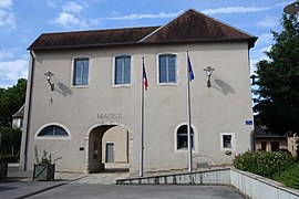 The town hall in Pirey | |
 Coat of arms | |
show Location of Pirey | |
 Pirey | |
| Coordinates: 47°15′45″N 5°57′50″E / 47.2625°N 5.9639°ECoordinates: 47°15′45″N 5°57′50″E / 47.2625°N 5.9639°E | |
| Country | France |
| Region | Bourgogne-Franche-Comté |
| Department | Doubs |
| Arrondissement | Besançon |
| Canton | Besançon-2 |
| Intercommunality | Grand Besançon Métropole |
| Government | |
| • Mayor (2008–2014) | Robert Stépourjine |
| Area 1 | 6.67 km2 (2.58 sq mi) |
| Population (Jan. 2018)[1] | 2,093 |
| • Density | 310/km2 (810/sq mi) |
| Time zone | UTC+01:00 (CET) |
| • Summer (DST) | UTC+02:00 (CEST) |
| INSEE/Postal code | 25454 /25480 |
| Elevation | 260–370 m (850–1,210 ft) |
| 1 French Land Register data, which excludes lakes, ponds, glaciers > 1 km2 (0.386 sq mi or 247 acres) and river estuaries. | |


Pirey is a commune in the Doubs department in the Bourgogne-Franche-Comté region in eastern France.
Population[]
| Year | Pop. | ±% |
|---|---|---|
| 1962 | 404 | — |
| 1968 | 459 | +13.6% |
| 1975 | 818 | +78.2% |
| 1982 | 1,055 | +29.0% |
| 1990 | 1,234 | +17.0% |
| 1999 | 1,441 | +16.8% |
| 2008 | 1,772 | +23.0% |
| 2012 | 2,060 | +16.3% |
See also[]
References[]
- ^ "Populations légales 2018". INSEE. 28 December 2020.
| Wikimedia Commons has media related to Pirey. |
This Doubs geographical article is a stub. You can help Wikipedia by . |
Categories:
- Communes of Doubs
- Doubs geography stubs