Durnes
Durnes | |
|---|---|
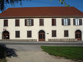 The town hall in Durnes | |
show Location of Durnes | |
 Durnes | |
| Coordinates: 47°06′32″N 6°13′56″E / 47.1089°N 6.2322°ECoordinates: 47°06′32″N 6°13′56″E / 47.1089°N 6.2322°E | |
| Country | France |
| Region | Bourgogne-Franche-Comté |
| Department | Doubs |
| Arrondissement | Besançon |
| Canton | Ornans |
| Government | |
| • Mayor (2008–2014) | Gilbert Husy |
| Area 1 | 8.51 km2 (3.29 sq mi) |
| Population (Jan. 2018)[1] | 176 |
| • Density | 21/km2 (54/sq mi) |
| Time zone | UTC+01:00 (CET) |
| • Summer (DST) | UTC+02:00 (CEST) |
| INSEE/Postal code | 25208 /25580 |
| Elevation | 388–618 m (1,273–2,028 ft) |
| 1 French Land Register data, which excludes lakes, ponds, glaciers > 1 km2 (0.386 sq mi or 247 acres) and river estuaries. | |


Durnes is a commune in the Doubs department in the Bourgogne-Franche-Comté region in eastern France.
Population[]
| Year | Pop. | ±% |
|---|---|---|
| 1962 | 73 | — |
| 1968 | 98 | +34.2% |
| 1975 | 90 | −8.2% |
| 1982 | 104 | +15.6% |
| 1990 | 127 | +22.1% |
| 1999 | 154 | +21.3% |
| 2008 | 156 | +1.3% |
| 2012 | 155 | −0.6% |
See also[]
References[]
- ^ "Populations légales 2018". INSEE. 28 December 2020.
| Wikimedia Commons has media related to Durnes. |
This Doubs geographical article is a stub. You can help Wikipedia by . |
Categories:
- Communes of Doubs
- Doubs geography stubs