Roche-lez-Beaupré
Roche-lez-Beaupré | |
|---|---|
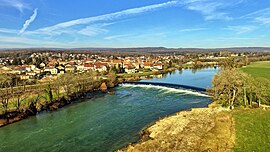 Roche-lez-Beaupré and the weir on the Doubs river | |
show Location of Roche-lez-Beaupré | |
 Roche-lez-Beaupré | |
| Coordinates: 47°16′37″N 6°06′54″E / 47.2769°N 6.115°ECoordinates: 47°16′37″N 6°06′54″E / 47.2769°N 6.115°E | |
| Country | France |
| Region | Bourgogne-Franche-Comté |
| Department | Doubs |
| Arrondissement | Besançon |
| Canton | Besançon-5 |
| Intercommunality | Grand Besançon Métropole |
| Government | |
| • Mayor (2008–2014) | Stéphane Courbet |
| Area 1 | 5.63 km2 (2.17 sq mi) |
| Population (Jan. 2018)[1] | 2,140 |
| • Density | 380/km2 (980/sq mi) |
| Time zone | UTC+01:00 (CET) |
| • Summer (DST) | UTC+02:00 (CEST) |
| INSEE/Postal code | 25495 /25220 |
| Elevation | 242–339 m (794–1,112 ft) |
| 1 French Land Register data, which excludes lakes, ponds, glaciers > 1 km2 (0.386 sq mi or 247 acres) and river estuaries. | |


Roche-lez-Beaupré is a commune in the Doubs department in the Bourgogne-Franche-Comté region in eastern France.
Geography[]
The commune lies 9 km (5.6 mi) northeast of Besançon on the banks of the Doubs River.
History[]
The commune was known as Roche until 1934.
Population[]
| Year | Pop. | ±% |
|---|---|---|
| 1962 | 1,091 | — |
| 1968 | 1,170 | +7.2% |
| 1975 | 1,372 | +17.3% |
| 1982 | 1,586 | +15.6% |
| 1990 | 1,663 | +4.9% |
| 1999 | 2,062 | +24.0% |
| 2008 | 2,070 | +0.4% |
| 2012 | 2,024 | −2.2% |
Transportation[]
The commune is served by the railroad, national highway 83, and the navigable Doubs River.
Economy[]
Industries including fertilizer and metalworking have been established in the commune.
See also[]
References[]
- ^ "Populations légales 2018". INSEE. 28 December 2020.
External links[]
| Wikimedia Commons has media related to Roche-lez-Beaupré. |
- Official website (in French)
- Roche-lez-Beaupré on the regional Web site (in French)
| show Authority control |
|---|
This Doubs geographical article is a stub. You can help Wikipedia by . |
Categories:
- Communes of Doubs
- Doubs geography stubs