Hyémondans
Hyémondans | |
|---|---|
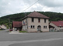 The town hall in Hyémondans | |
 Coat of arms | |
show Location of Hyémondans | |
 Hyémondans | |
| Coordinates: 47°23′18″N 6°39′00″E / 47.3883°N 6.65°ECoordinates: 47°23′18″N 6°39′00″E / 47.3883°N 6.65°E | |
| Country | France |
| Region | Bourgogne-Franche-Comté |
| Department | Doubs |
| Arrondissement | Montbéliard |
| Canton | Bavans |
| Intercommunality | Deux Vallées Vertes |
| Government | |
| • Mayor (2020–2026) | Benoît Cuenot |
| Area 1 | 6.87 km2 (2.65 sq mi) |
| Population (Jan. 2018)[1] | 205 |
| • Density | 30/km2 (77/sq mi) |
| Time zone | UTC+01:00 (CET) |
| • Summer (DST) | UTC+02:00 (CEST) |
| INSEE/Postal code | 25311 /25250 |
| Elevation | 399–821 m (1,309–2,694 ft) |
| 1 French Land Register data, which excludes lakes, ponds, glaciers > 1 km2 (0.386 sq mi or 247 acres) and river estuaries. | |


Hyémondans (French pronunciation: [jemɔ̃dɑ̃]) is a commune in the Doubs department in the Bourgogne-Franche-Comté region in eastern France.
Population[]
| Year | Pop. | ±% |
|---|---|---|
| 1962 | 90 | — |
| 1968 | 104 | +15.6% |
| 1975 | 100 | −3.8% |
| 1982 | 148 | +48.0% |
| 1990 | 151 | +2.0% |
| 1999 | 139 | −7.9% |
| 2008 | 191 | +37.4% |
| 2012 | 197 | +3.1% |
See also[]
References[]
- ^ "Populations légales 2018". INSEE. 28 December 2020.
| Wikimedia Commons has media related to Hyémondans. |
This Doubs geographical article is a stub. You can help Wikipedia by . |
Categories:
- Communes of Doubs
- Doubs geography stubs