Métabief
Métabief | |
|---|---|
 The church in Métabief | |
show Location of Métabief | |
 Métabief | |
| Coordinates: 46°46′27″N 6°21′09″E / 46.7742°N 6.3525°ECoordinates: 46°46′27″N 6°21′09″E / 46.7742°N 6.3525°E | |
| Country | France |
| Region | Bourgogne-Franche-Comté |
| Department | Doubs |
| Arrondissement | Pontarlier |
| Canton | Frasne |
| Government | |
| • Mayor (2008–2014) | Gérard Deque |
| Area 1 | 5.76 km2 (2.22 sq mi) |
| Population (Jan. 2018)[1] | 1,268 |
| • Density | 220/km2 (570/sq mi) |
| Time zone | UTC+01:00 (CET) |
| • Summer (DST) | UTC+02:00 (CEST) |
| INSEE/Postal code | 25380 /25370 |
| Elevation | 923–1,419 m (3,028–4,656 ft) |
| 1 French Land Register data, which excludes lakes, ponds, glaciers > 1 km2 (0.386 sq mi or 247 acres) and river estuaries. | |


Métabief (French pronunciation: [metabje]) is a commune in the Doubs department in the Bourgogne-Franche-Comté region in eastern France.
Geography[]
The commune lies 14 km (8.7 mi) northeast of Mouthe close to the Swiss border near Jougne.
Population[]
| Year | Pop. | ±% |
|---|---|---|
| 1962 | 123 | — |
| 1968 | 165 | +34.1% |
| 1975 | 197 | +19.4% |
| 1982 | 250 | +26.9% |
| 1990 | 504 | +101.6% |
| 1999 | 691 | +37.1% |
| 2008 | 954 | +38.1% |
| 2012 | 1,089 | +14.2% |
Tourism[]
Métabief is known for its winter sports, but it is also a center for tourism in the summer with hiking, mountain biking, hang gliding, mountain climbing, and spelunking. It is one of the six communes that operate the ski resort.
Gallery[]
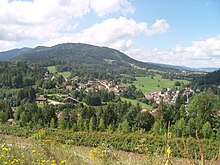
The Morond, seen from Les Hôpitaux-Neufs
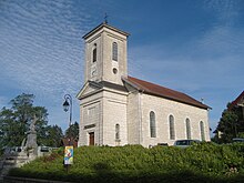
The church
See also[]
References[]
- ^ "Populations légales 2018". INSEE. 28 December 2020.
External links[]
| Wikimedia Commons has media related to Métabief. |
| show Authority control |
|---|
This Doubs geographical article is a stub. You can help Wikipedia by . |
Categories:
- Communes of Doubs
- Doubs geography stubs